prayash.io
Chomolungma: Into the Heart of Khumbu
October 9, 2024
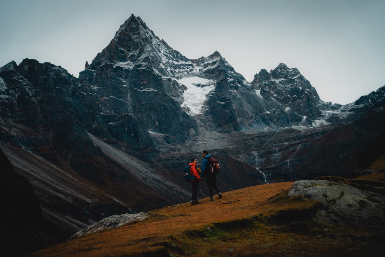
The wind howled through the valley as we stood at the base of the Cho La Pass ascent, staring up at what looked like a sheer wall of snow and rock. I looked down at my watch: it was 4 PM. We had been walking nonstop since 5 in the morning. The fresh snow from the last two days had erased any sign of a trail. Just an untouched, blinding white slope stretching toward the top. No footprints were present, and it was just us, the mountain, and the fading light. My legs burned from the day's climb, but there wasn't much time to rest. The sun was sinking fast, and we couldn't afford to be caught on this ascent in the dark.
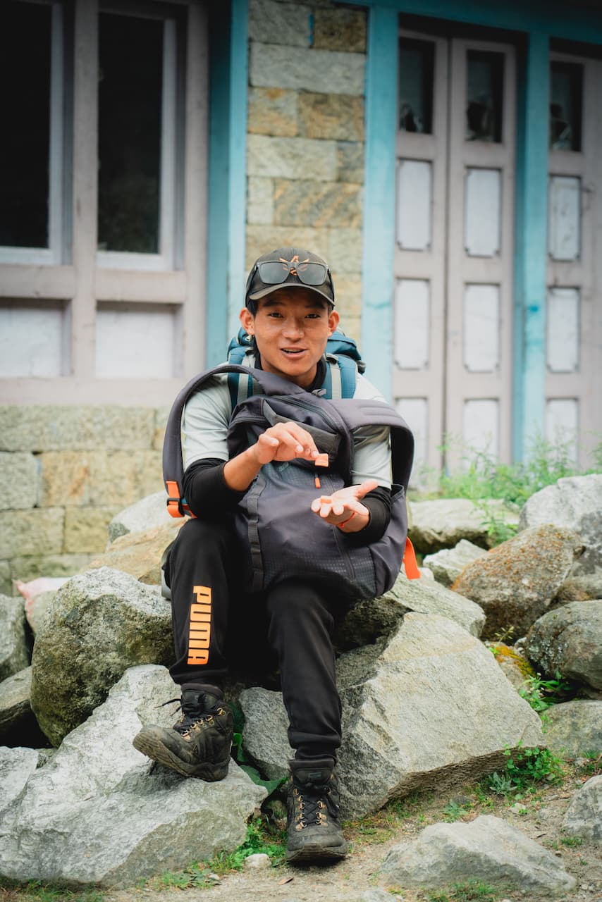
I reached for the first metal cable. My gloved fingers stiff from the cold. Pulling myself up with all my might. The snow shifted beneath my boots and forced me to dig in with every step. The delirium of the altitude had already settled in. At 5,387m / 17,600 ft, every step felt insurmountable. Every breath was fleeting. I followed close behind Pallavi, moving with quiet determination, while our Sherpa brother Sonam led the way, his footsteps sure and practiced.
The silence was eerie. Just the crunch of our boots coming in loud and clear. No voices, no distant trekkers, no safety net. It was just the three of us, alone in this vast, frozen world, racing against the sun, pushing our bodies just a little further. October was supposed to be the ideal season for this trek, how did we end up in this situation?
10 days earlier, standing in the chaos of Lukla's tiny airstrip, I had no idea how much this journey would push me to my limits. How our perfectly planned 14-day itinerary would get derailed by a record snowstorm halfway through. And against all odds, we'd charge ahead even when everyone else was turning around.
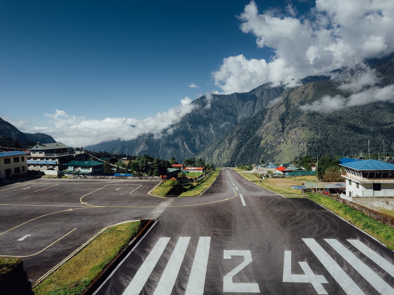
Lukla / लुक्ला — 2,846m (9,337 ft)
After an exhilarating 25 minute flight in a tiny, 20-passenger propeller airplane, cruising above the mountains of Solukhumbu, we landed on the short and inclined runway at Lukla, the most dangerous airport in the world.
The 'baggage claim', if you want to call it that, was a small concrete enclave inside the terminal with a man collecting paper vouchers, which were tokens exchanged for bags. Check out that runway, though.
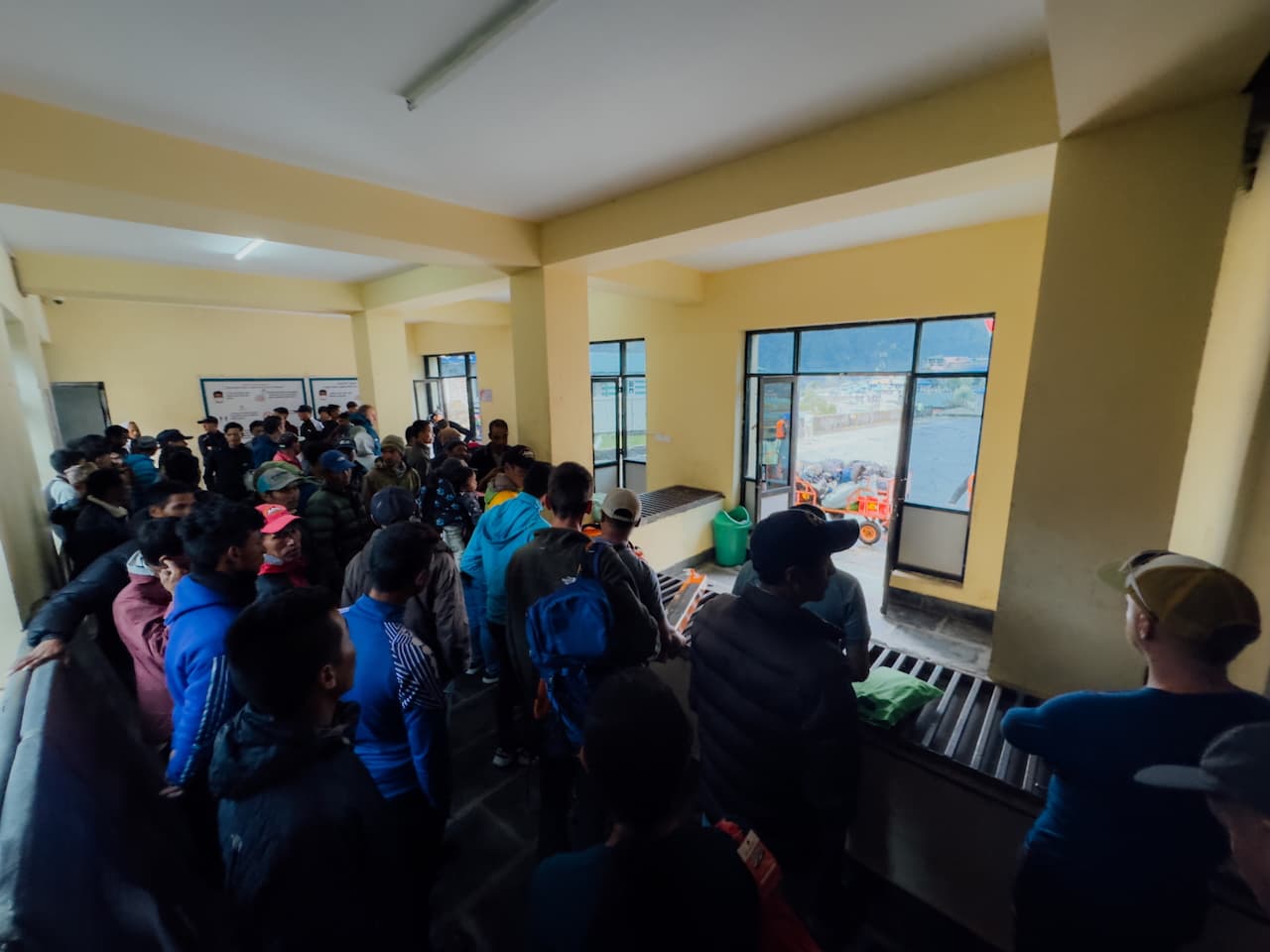
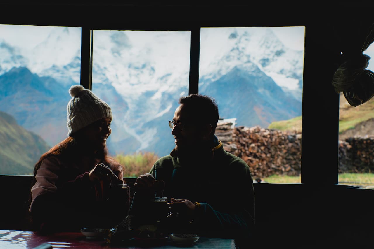
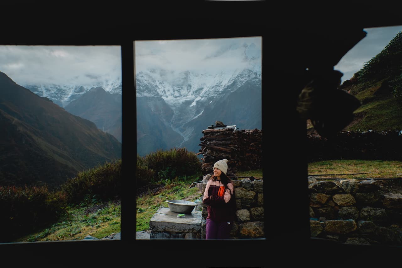
A slender, smiley, dark-skinned fella greeted us on our way into the cramped terminal, which was flooded with trekkers waiting to pick up their bags. That's Sonam, our trusty Sherpa guide who was also going to be carrying our 25kg bag on his back for the entire duration of the trek. We hit it off with Sonam right away. He was a charming but shy dude. We had a cup of chiya and some breakfast before starting the first leg of the trek.

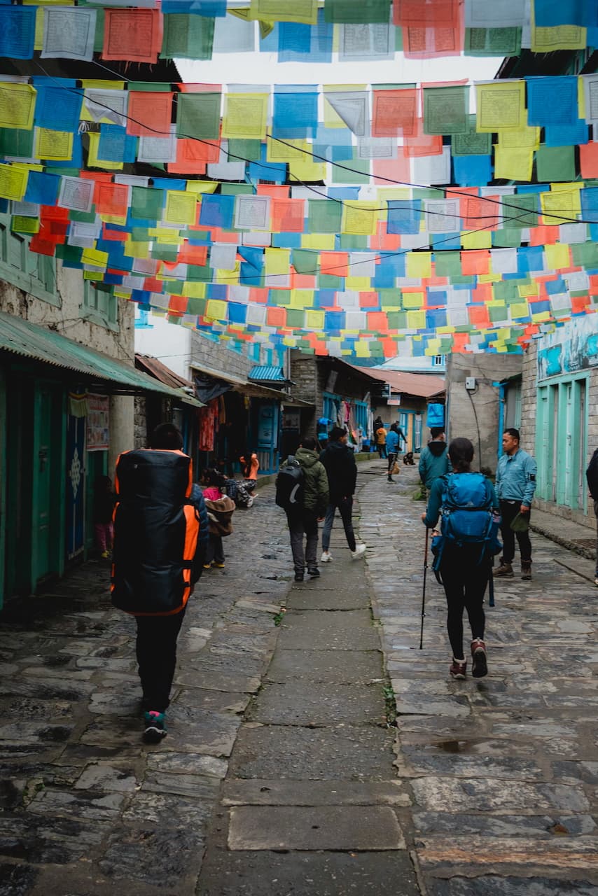
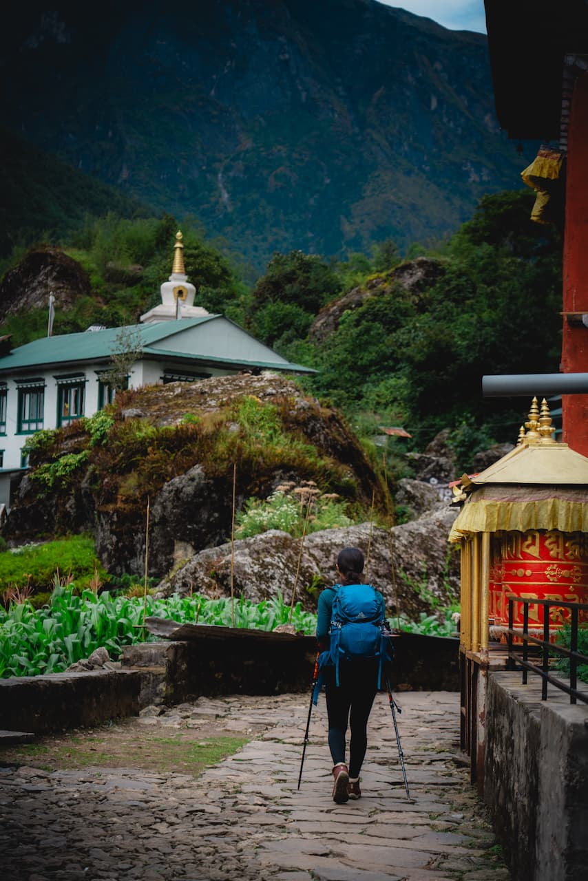
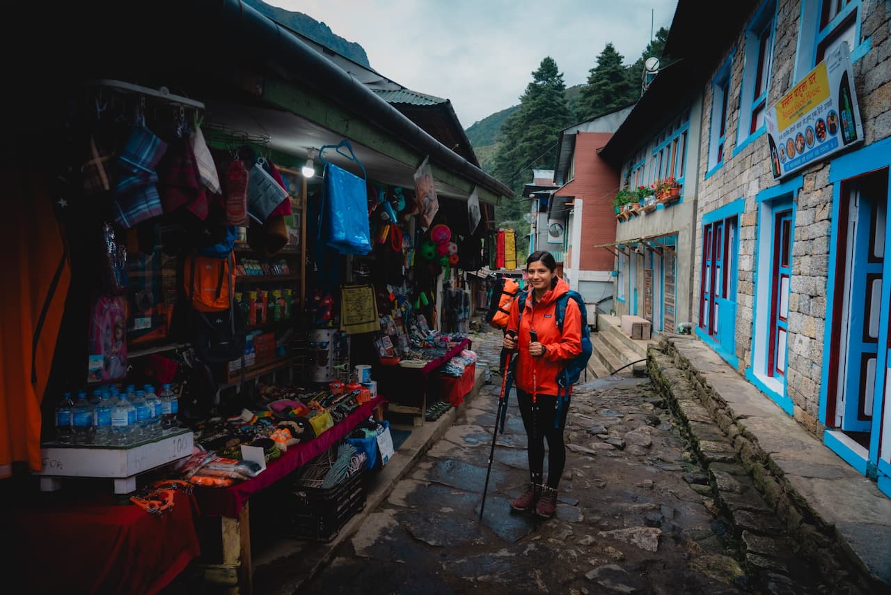
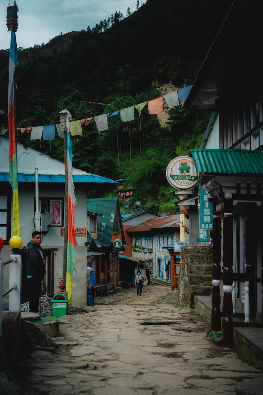
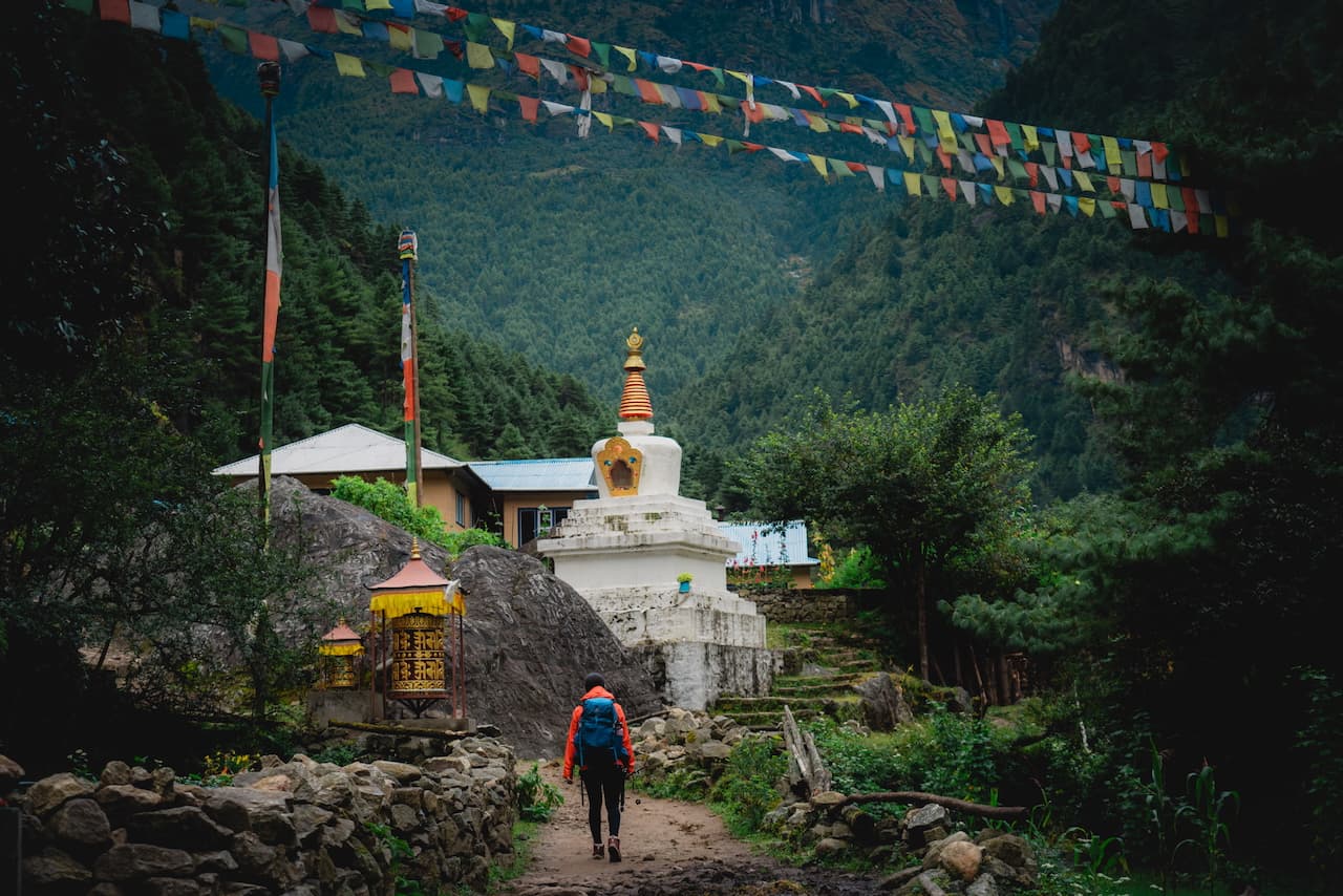
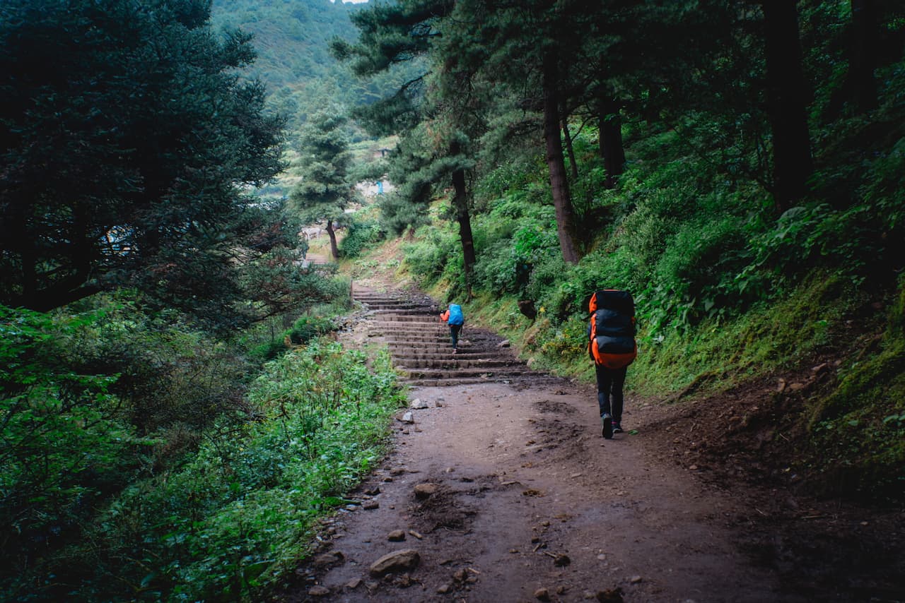
On the way to Phakding, we passed numerous smaller villages, all with their own charm. The scenery wasn't filled with epic Himalayan peaks, but rather beautiful grassy hills, stupas en route, and of course passerby's. It's only the beginning, so the excitement was palpable on the trail when passing by other trekkers.
Phakding / फाक्दिङ — 2,623m (8,600 ft)
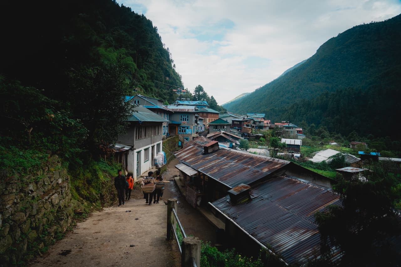
3 hours later, we were in the small, idyllic village of Phakding. It was really more of a descent than an ascent, but the whole route is undulating enough that I still felt it in my legs.
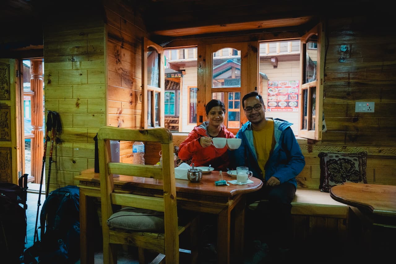
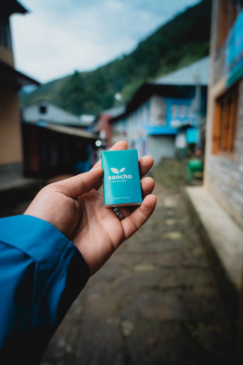
The vibes were great, and we settled into a tea house, had dinner, and walked around. I stopped by one of the street-side shops to buy myself a pack of Sancho, which is essential oil blend commonly used for treating colds and fevers. It's quite popular in Nepal. The onset of a cold and sore throat was not a good sign for me. I've always had terrible luck when it comes to getting sick on trips.
We hit the hay early to start the next day on a good note, as it's 4,000+ ft of elevation gain on the trail to Namche Bazaar.
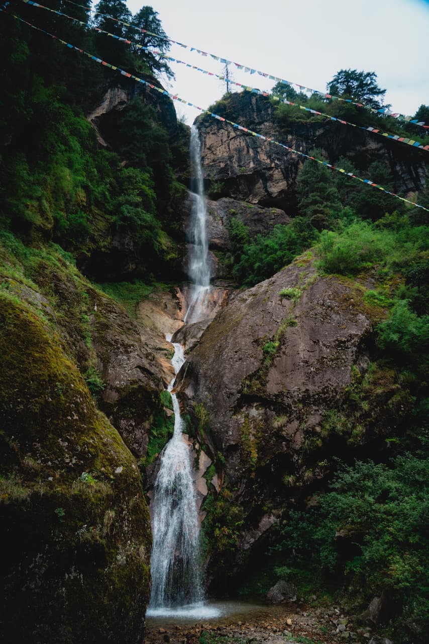
The next morning, we got a beautiful view of the mountains right after departing from Phakding. It was a crisp morning, which made the steady climb quite pleasant. Along the way, we were greeted by many more decorated stupas, waterfalls, and best of all: dogs.
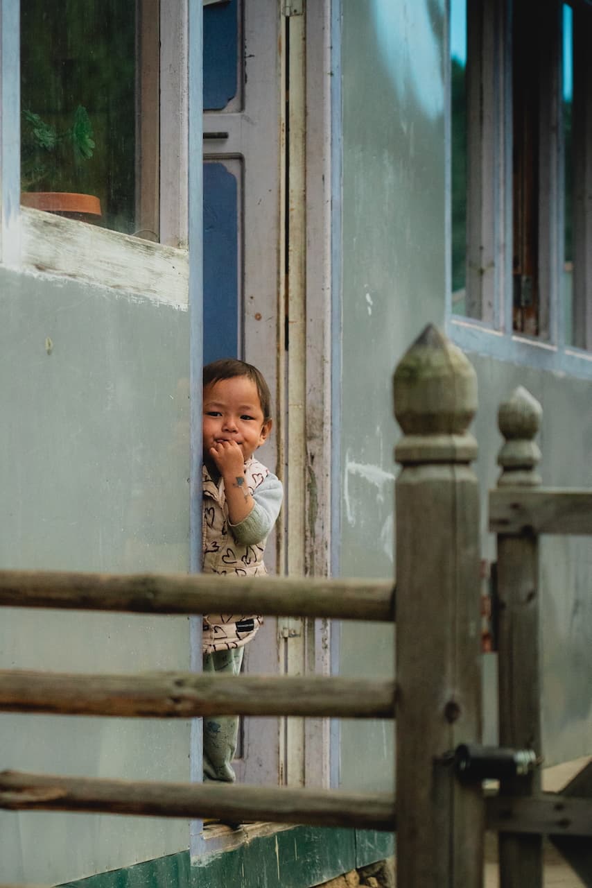
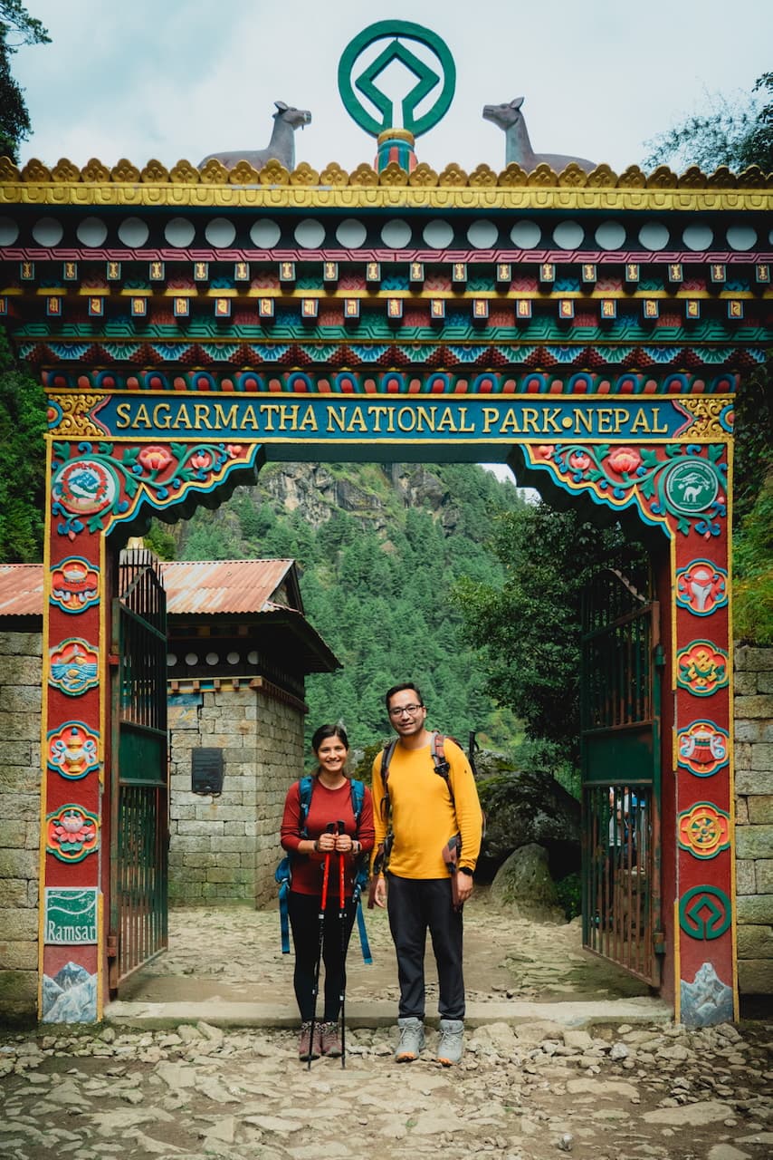
As we approached the Sagarmatha National Park entrance and trekking checkpoint (where we register for park passes), we met a kind porter who had never had lapsi candy before, so we shared some of ours with him while we were taking a quick breather. An adorable child peeked out of his home and made some funny faces at us, which warmed my heart.
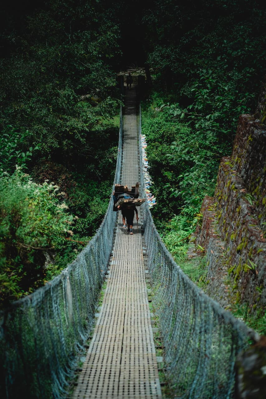
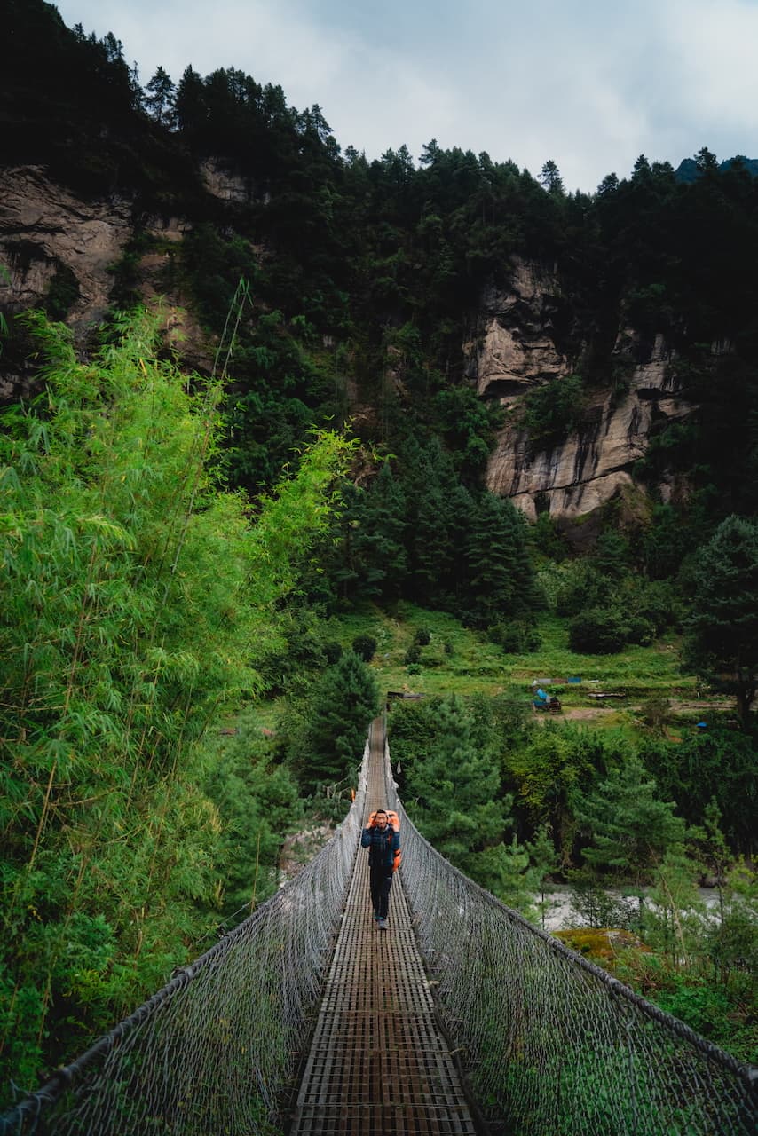
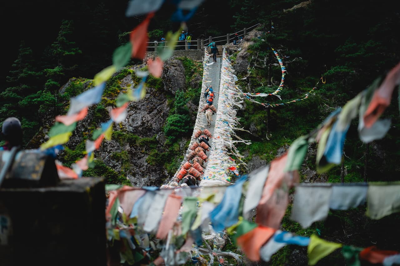
At last, we arrive at the village of Monjo, which has the main entrance into Sagarmatha National Park and an embedded army checkpoint. Once we got the paperwork sorted, we were on our way. After a grueling few hours of ascending, we reached Hillary Bridge. We stepped aside and waited for a large herd of mules carrying gas canisters up to Namche Bazaar. You don't want to be on the bridge when these fellas are passing through on a bridge, because they do not step aside for anyone.
The path to Namche wasn't much longer, but man, the ascent is pretty brutal. By this point, we saw many people question their decisions. Some even arrived at the conclusion that this wasn't for them, and they'd turn back after reaching Namche.
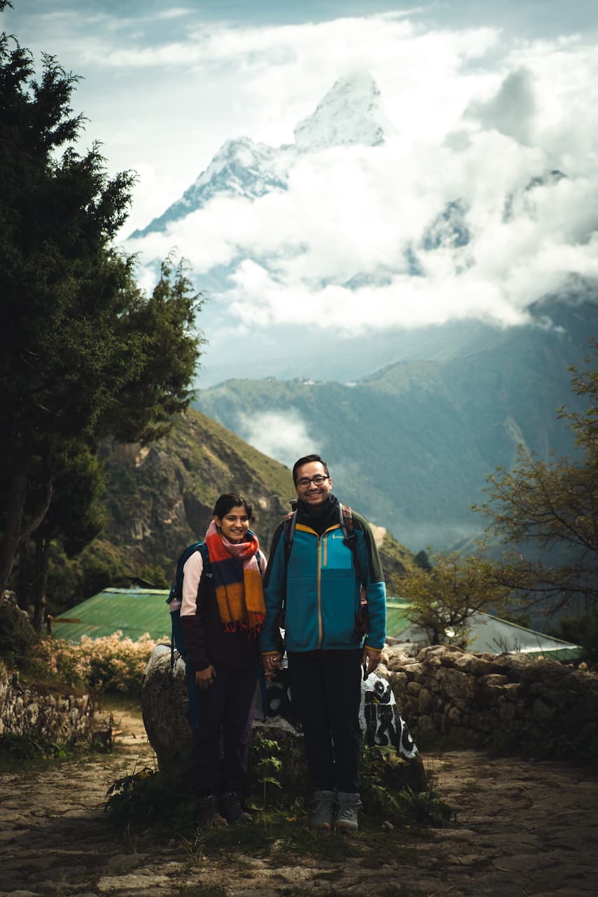
Pallavi and I are no expert hikers either, and we were also struggling. Our hiking repertoire consisted of the occasional day trip out of town or doing some well-known trails at national parks in the US. The only thing we had going for us was that, a few months before, we had backpacked the Laugavegur trail in Iceland. It gave us just enough confidence to attempt this trek.
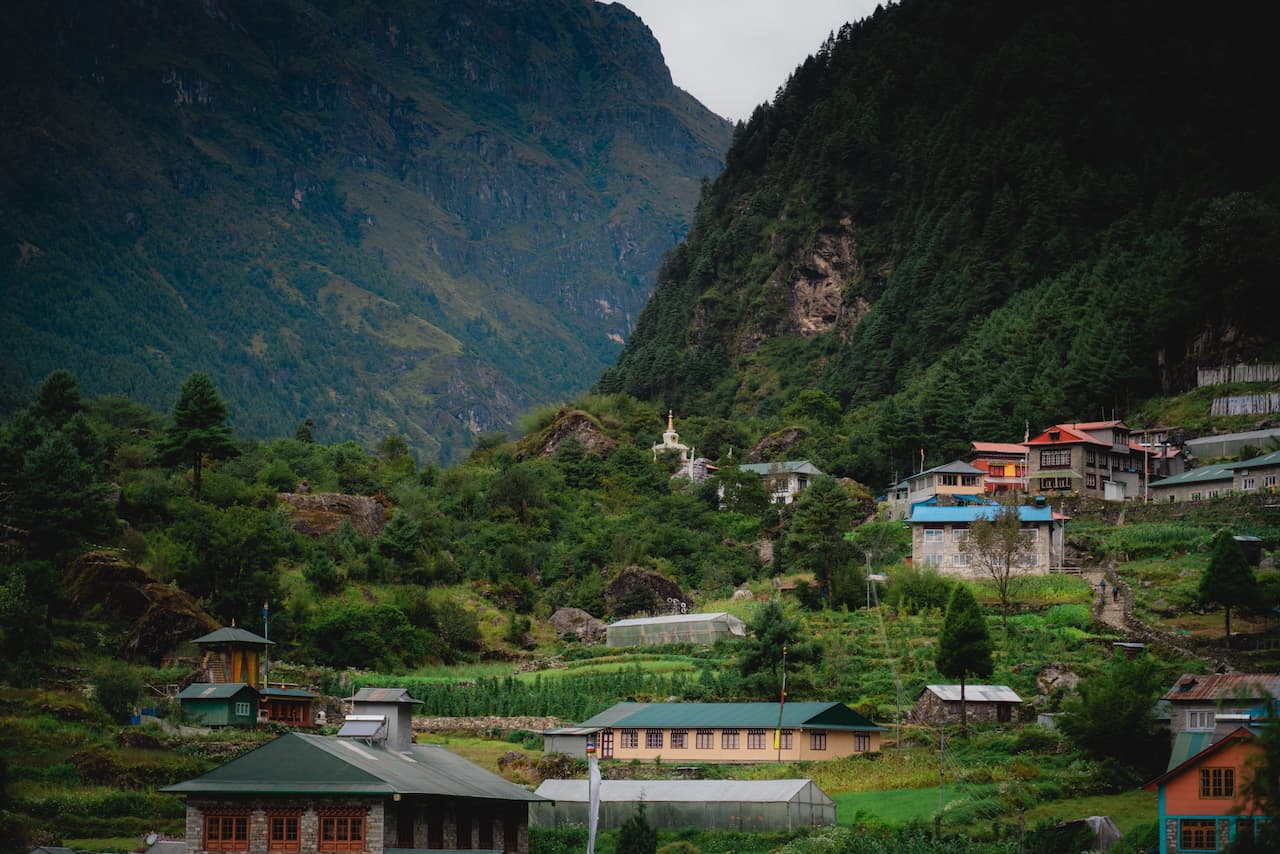
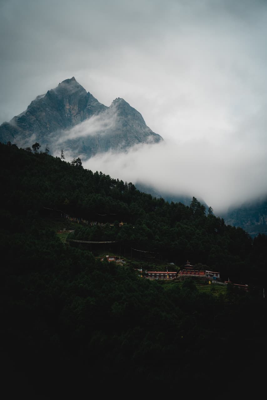
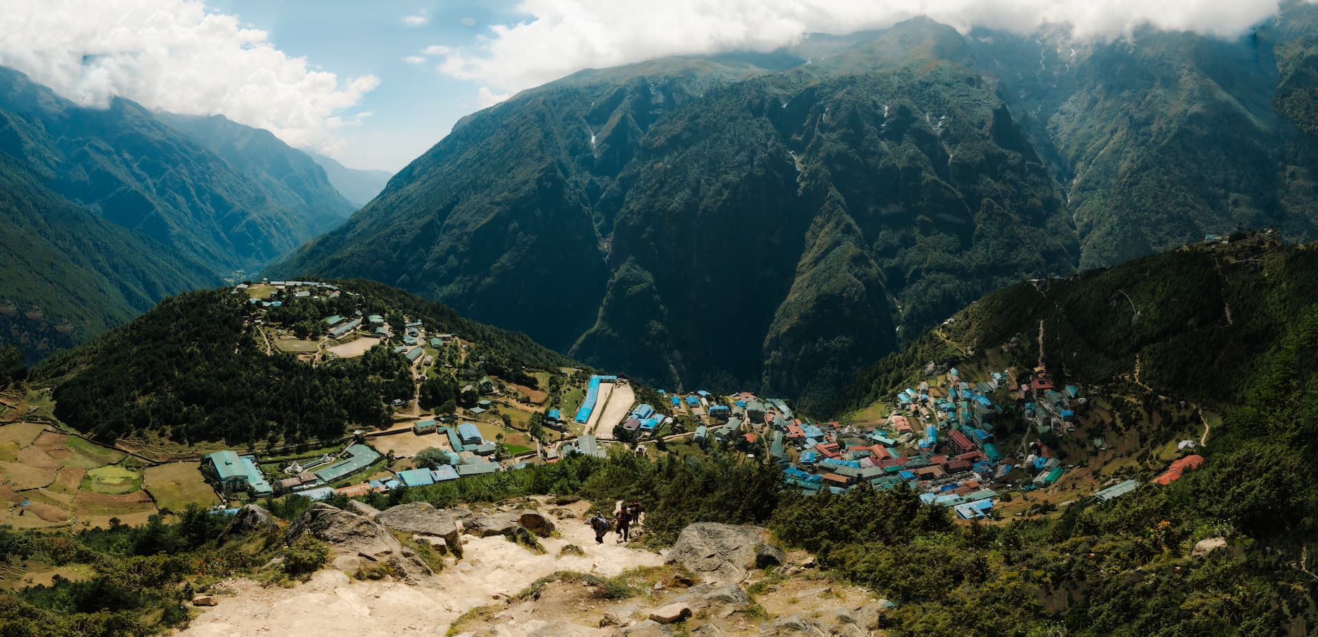
Namche Bazaar / नाम्चे बजार — 3,440m (11,200 ft)
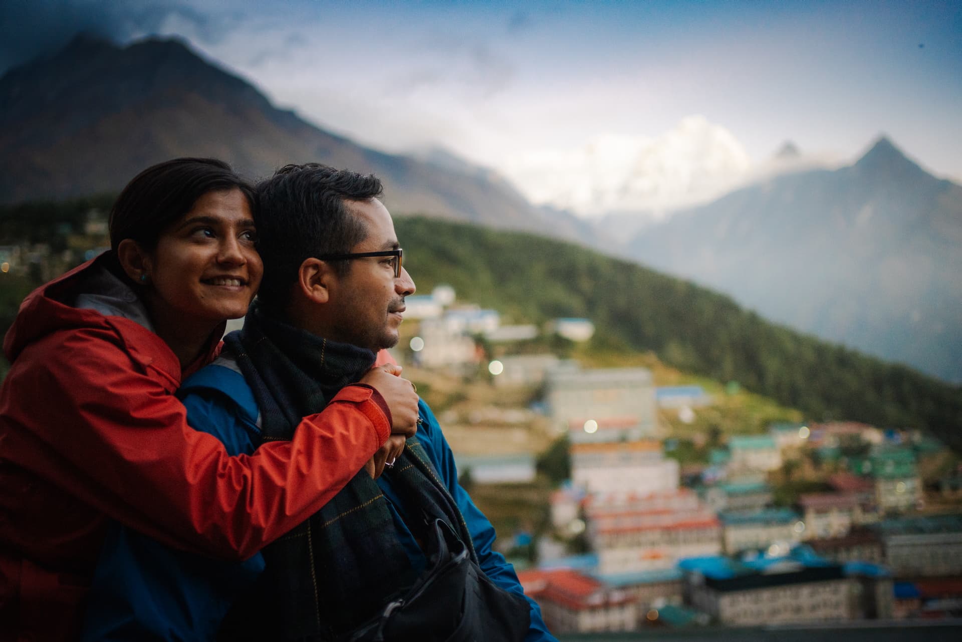
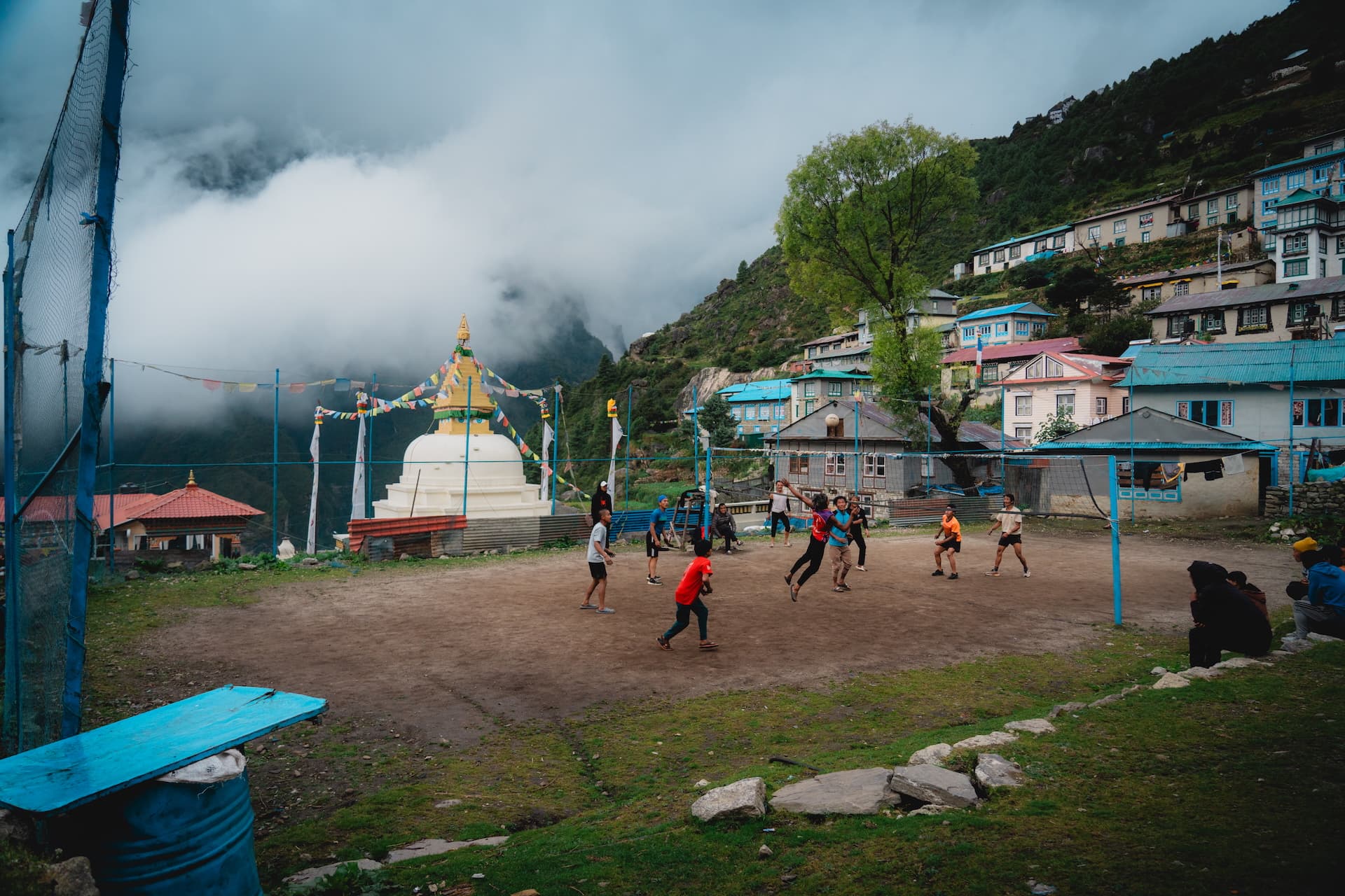
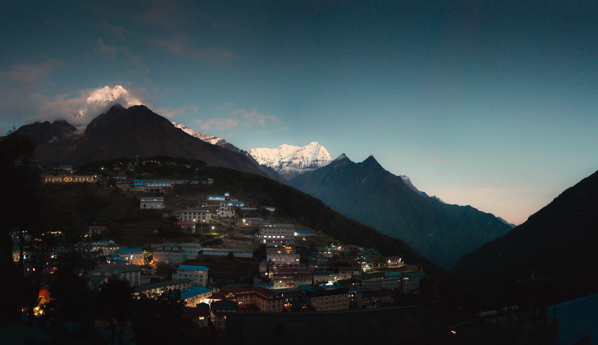
Upon arriving in Namche Bazaar, it became absurdly clear that we were now at the frontier of the Himalayas. Dusk brought in the cool air while we admired the sunset from a vantage point above the village.
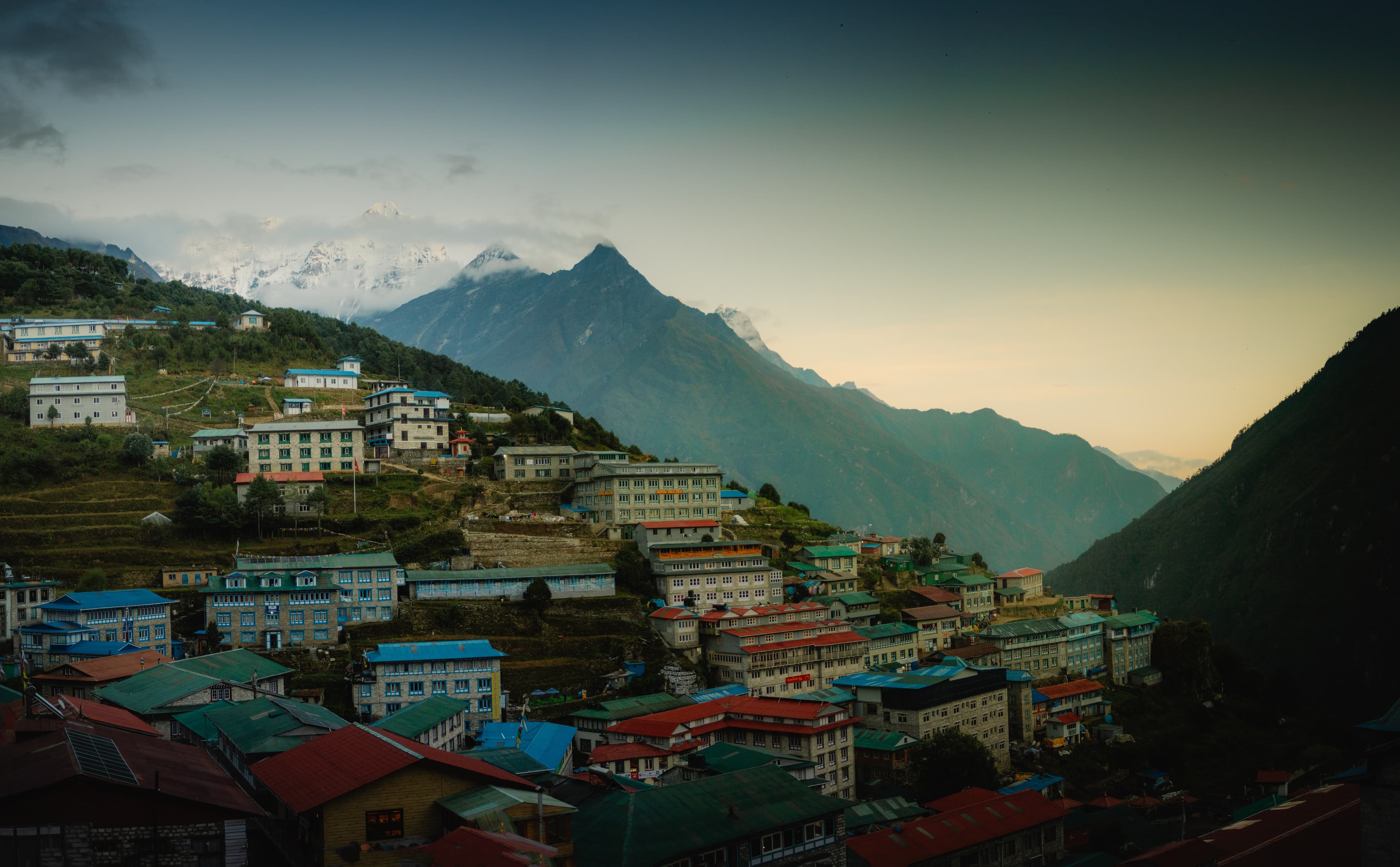
Youngins playing volleyball at the school playground. Markets, cafés and restaurants were hustling and bustling with trekkers. Many of them at the beginning of their ascents, just like us. But many of them were celebrating the end of their treks, making one last stop at this sensationally beautiful town nestled deep in the Himalayas before the descent back to Lukla.
This is the last stop to get essential supplies and gear, and it's also the last place where they recommend eating meat, because many luxuries of life (like refrigerators) become scarce from this point on.
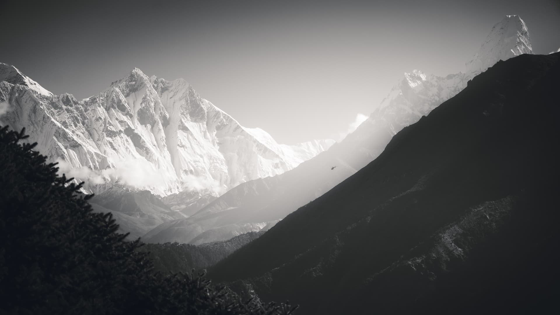
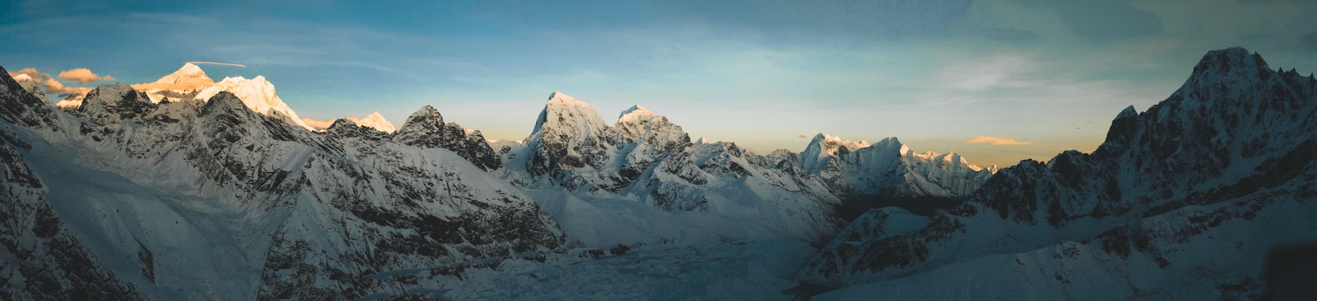
The next morning we made way straight for the Tenzing Norgay Memorial which sits at the very top of Namche, and on a clear day, gives you fantastic 360° views with Everest, Lhotse, Ama Dablam, Kyashar and Kusum Kanguru.
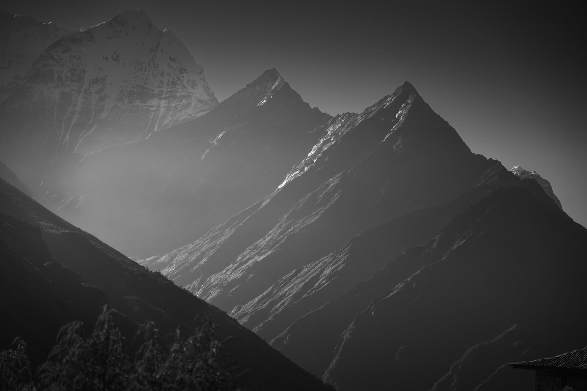
Clear days like these means you'll see the occasional helicopter flying to base camp.
We made way to the nearby Sherpa Culture Museum, which unfortunately didn't allow any photos. But it was a very educational experience with a ton of photos and video exhibits packed inside explaining the history of the Sherpa people in the Khumbu.
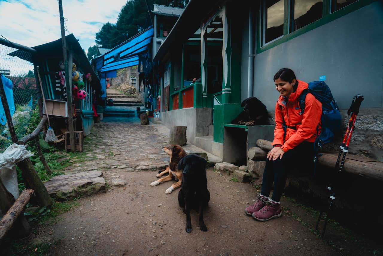
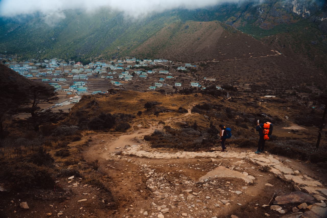
Many trekkers choose to descend back down to Namche and spend another night there to acclimatize, but we decided to climb slightly higher to the village of Khumjung instead. The climb gets steep approaching Syangboche, but views were great. Here's another vantage point of Namche Bazaar. You can see the Sherpa museum with the stupa on the lower left, and the Nepalese Army base on the upper left.
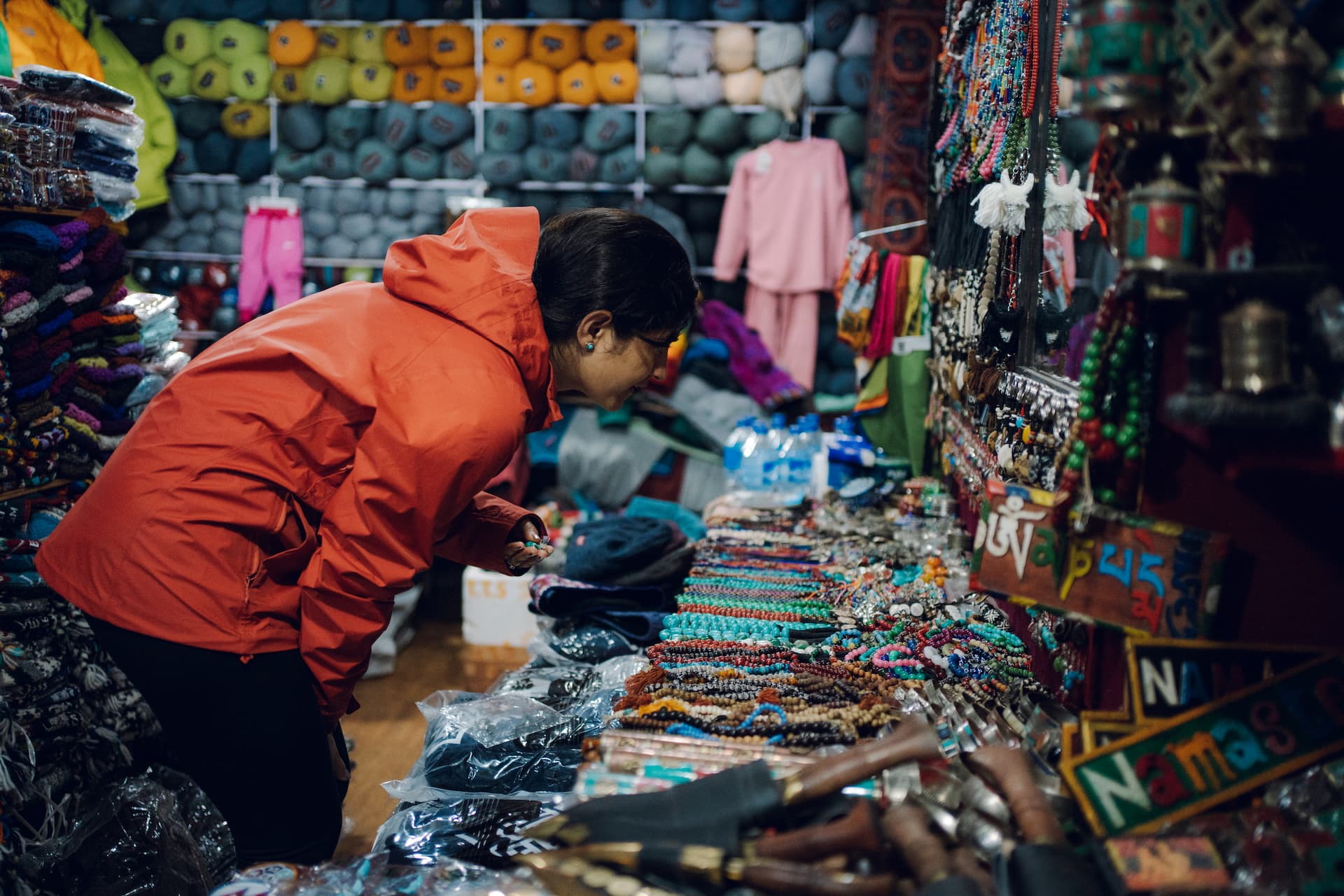
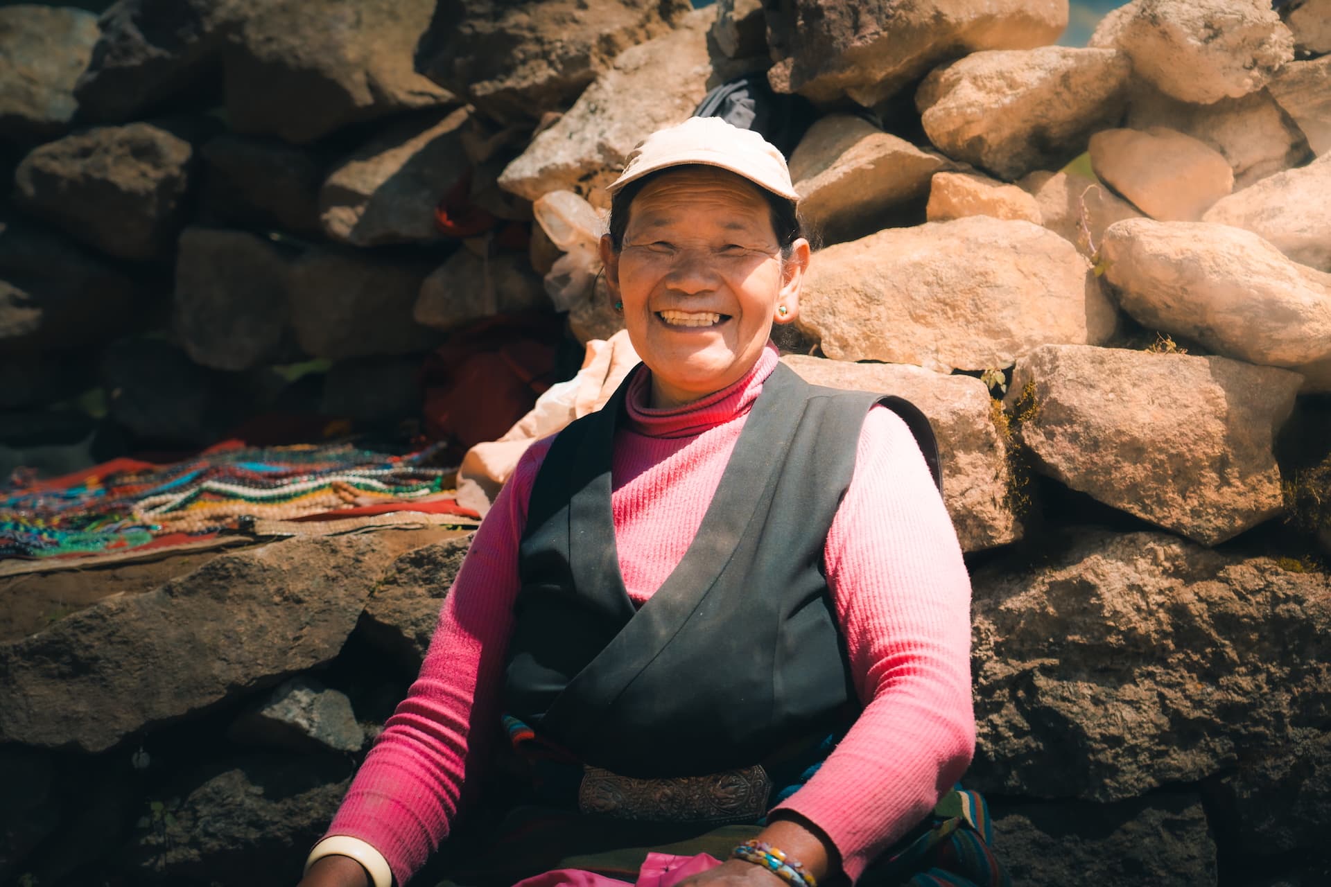
We were lucky enough to get to visit the army base (although weren't allowed to take pictures inside) for breakfast, too. Along the way up, we met an uber jolly Sherpa lady on the trail selling various trinkets and handmade jewelry. I was more than happy to pick up a couple decorative items for my backpack. She had a gigantic smile when I asked her if I could snap a photo of her.
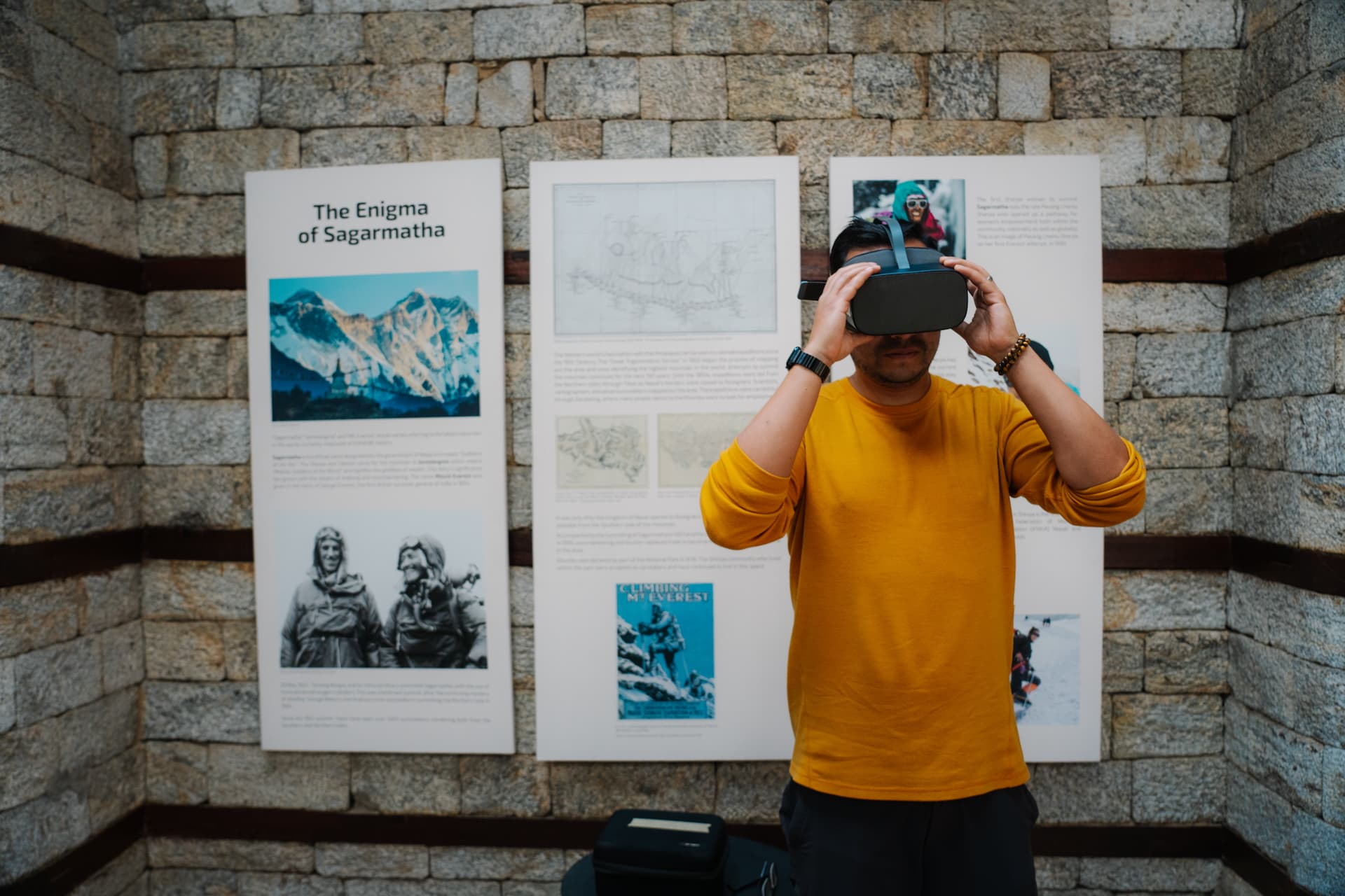
Hiking higher up, we ended up at Sagarmatha Next, which is a nonprofit focusing on sustainability in the Khumbu region. They mainly invest in waste management and tourist education, shining light on the dichotomy of the massive socio-economic development in the area and the pressure it has inflicted on its biodiversity and delicate ecosystems during the last few decades. There were art installations and educational videos, and they even had mobile-VR headsets for watching immersive 360° videos along the Everest massif.
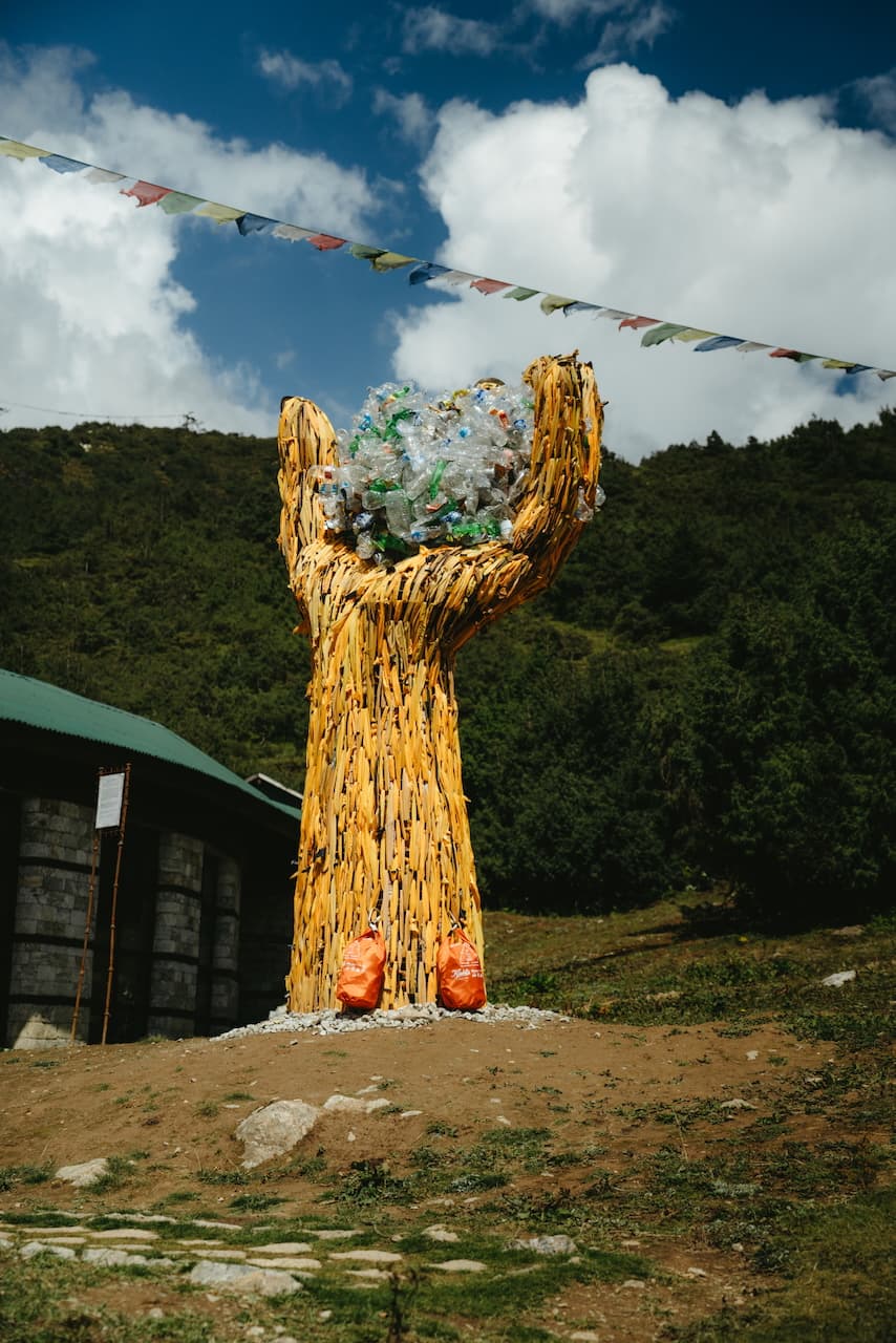
It was eye-opening hearing the stories of the Tibetan refugees and Sherpas that reside here—not just the glamor, but their mistreatment from the Nepalese government and the dark side of the hyper commercialization of trekking and mountaineering. We saw the sharp contrast between the influx of trekkers and the resilience of a community deeply rooted in tradition, yet constantly adapting to the pressures of tourism.
We began to understand that the Everest Base Camp trek is not just about hiking—it's a journey into the rich, sometimes harsh, intersection of culture, history, and the impact of a global fascination with these towering peaks. Namche isn't just a place to pass through; it's a place that reveals the resilience, complexity, and stories of the people who make the Himalayas their home.
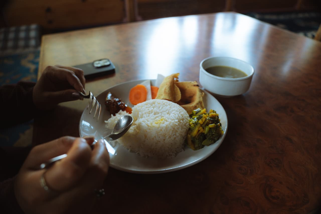
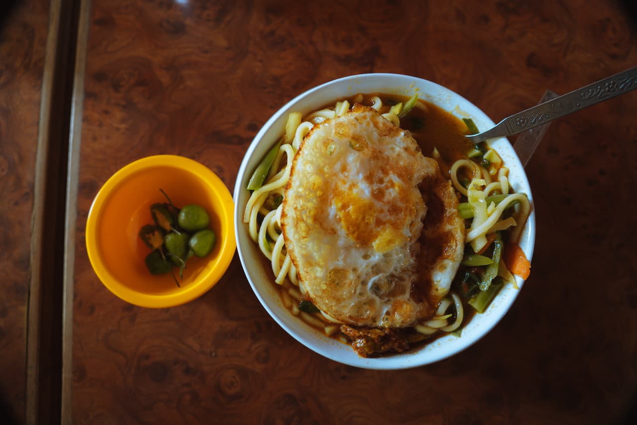
We had our lunch — I was eating thukpa everyday so I could shake off my cough and sore throat. Most days we ate dal bhaat. Can't forget the dalle cherry peppers, which is widely available everywhere in Nepal.
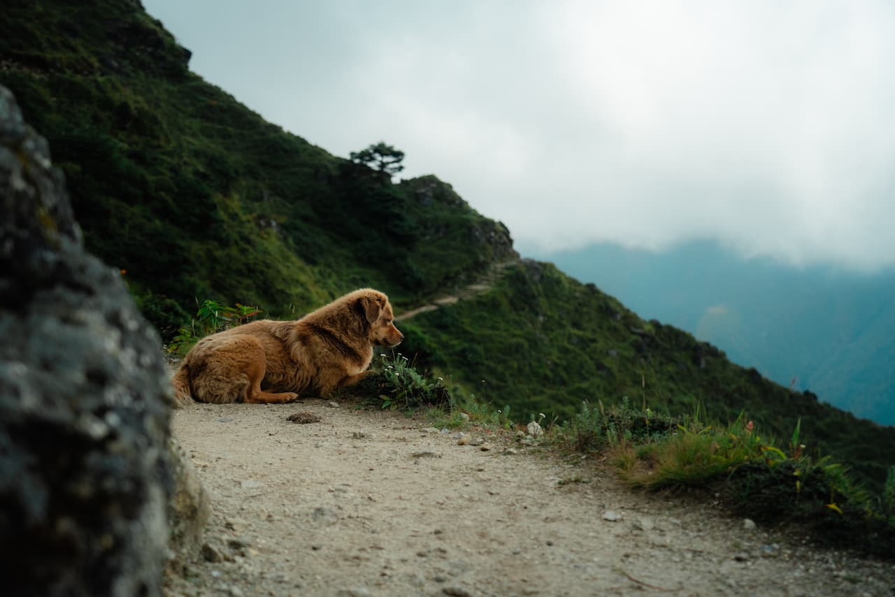
We made our away across the hillsides and into the fog, and a pup kindly led the way to show us the path ahead. After a full day of walking under the sun, the foggy atmosphere of Khumjung was much welcome.
Khumjung / खुम्जुंग — 3,700m (12,300 ft)
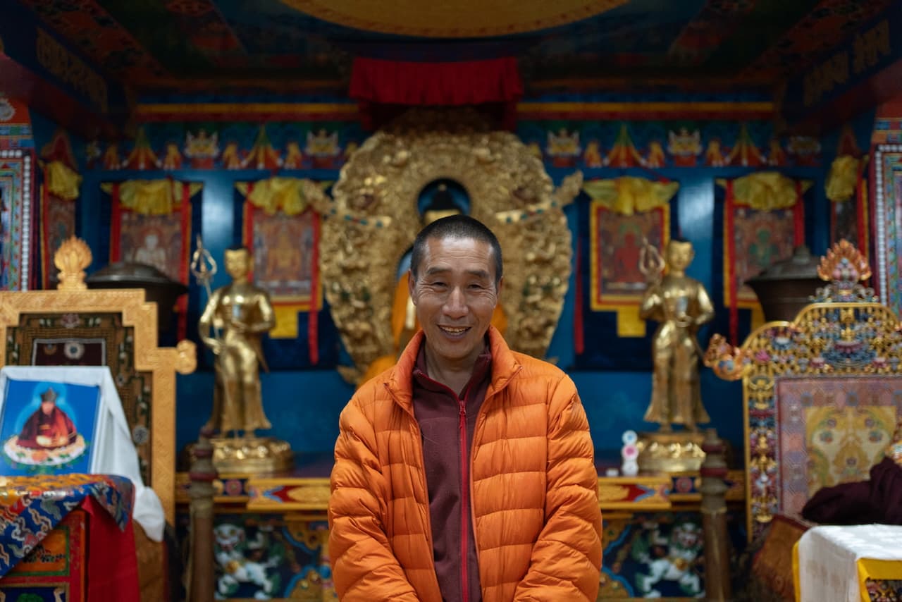
Upon arrival, we chose to stay at Mandala Lodge. The Sherpa owners were warm and welcoming. We were the only guests staying at the lodge (given that it's still early in the season), so while the hosts cooked dinner, we decided to hit up Khumjung Monastery and check out the school that Edmund Hillary built.
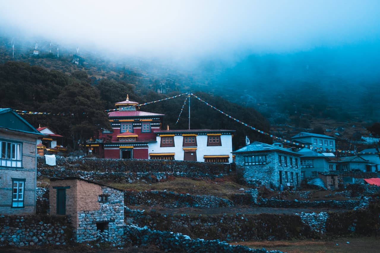
The monastery was beautiful, with its interior fully ornamented with Buddhist statues and relics. Though we were well past closing time, the head monk, a jolly devotee with the biggest smile, who lived there was happy to give us a private tour.
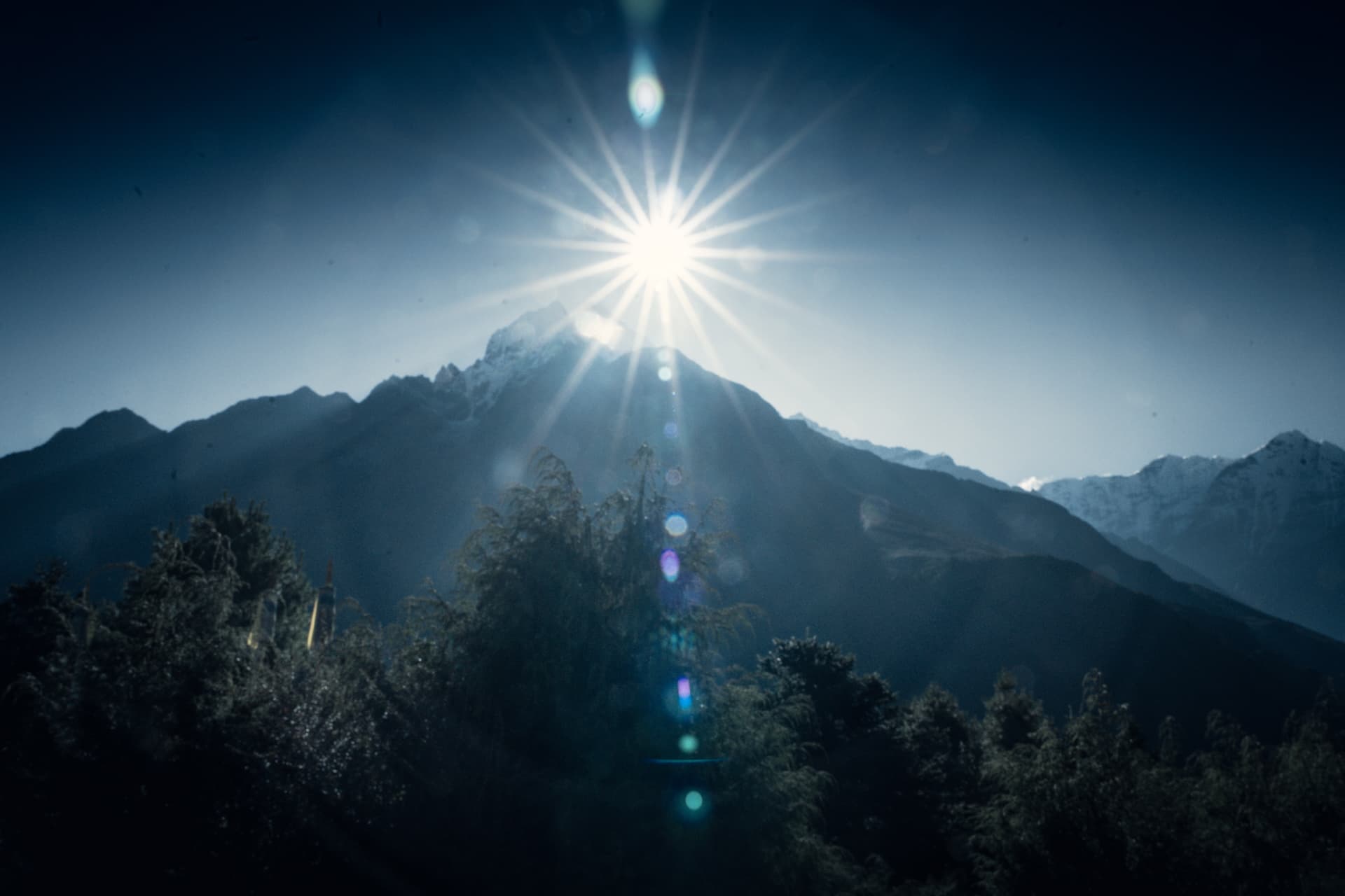
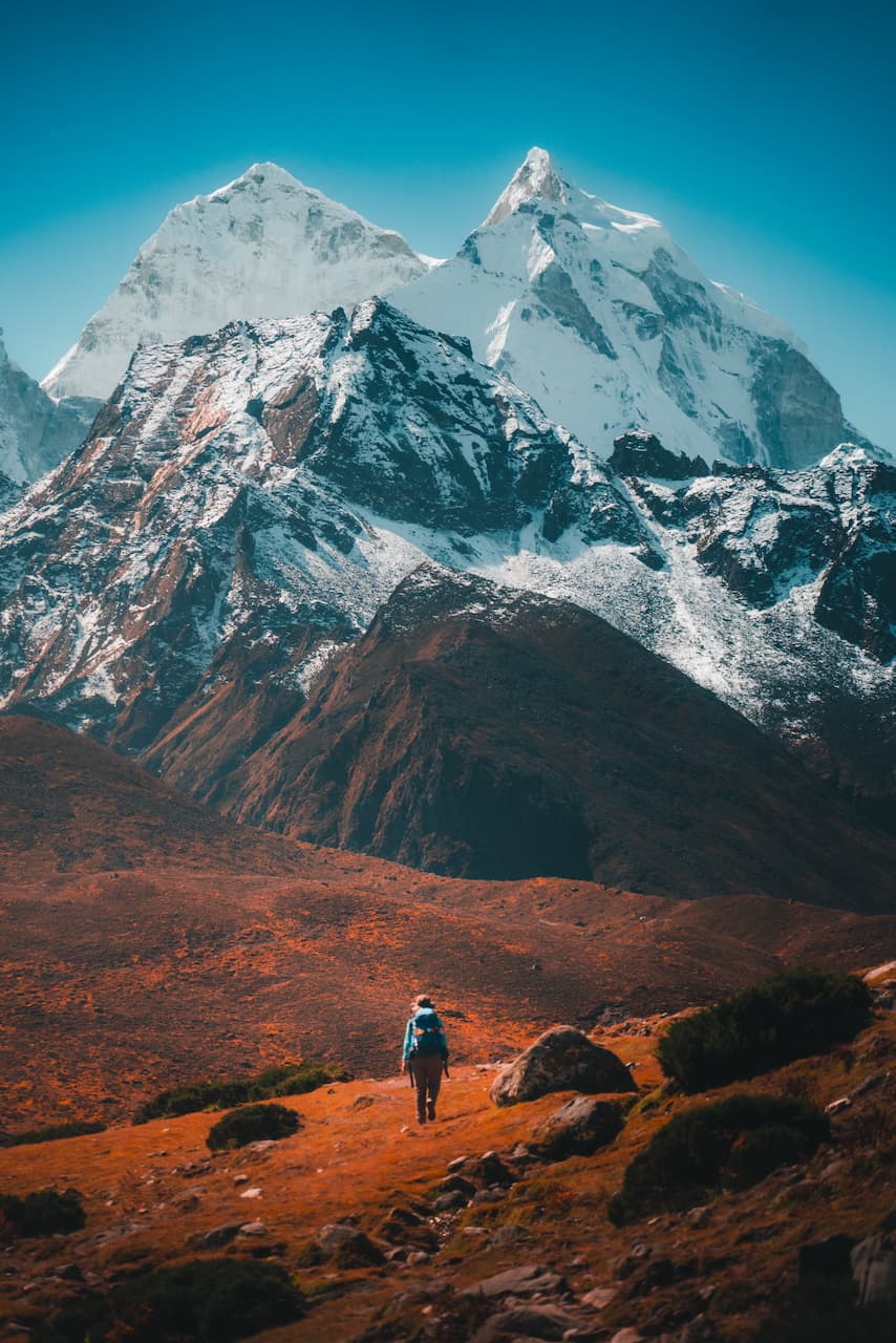
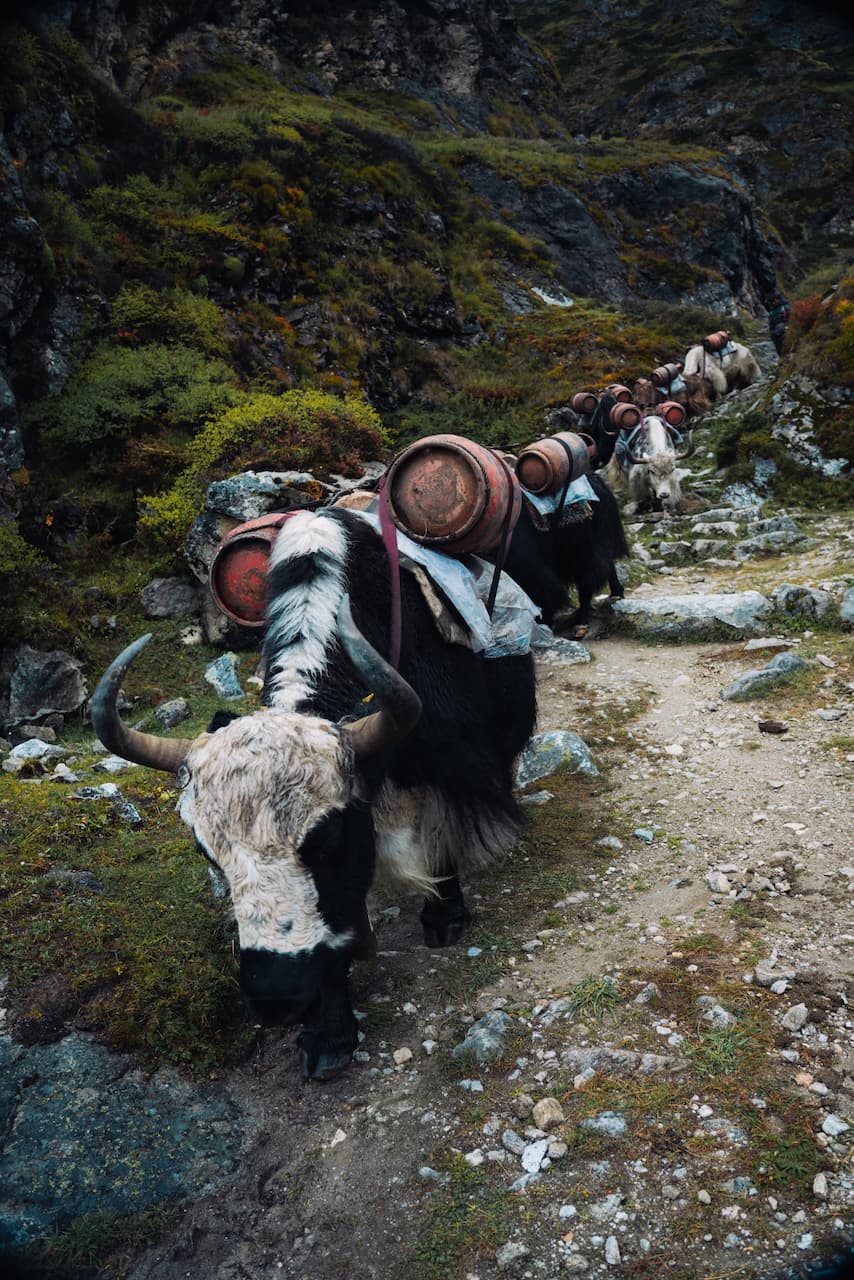
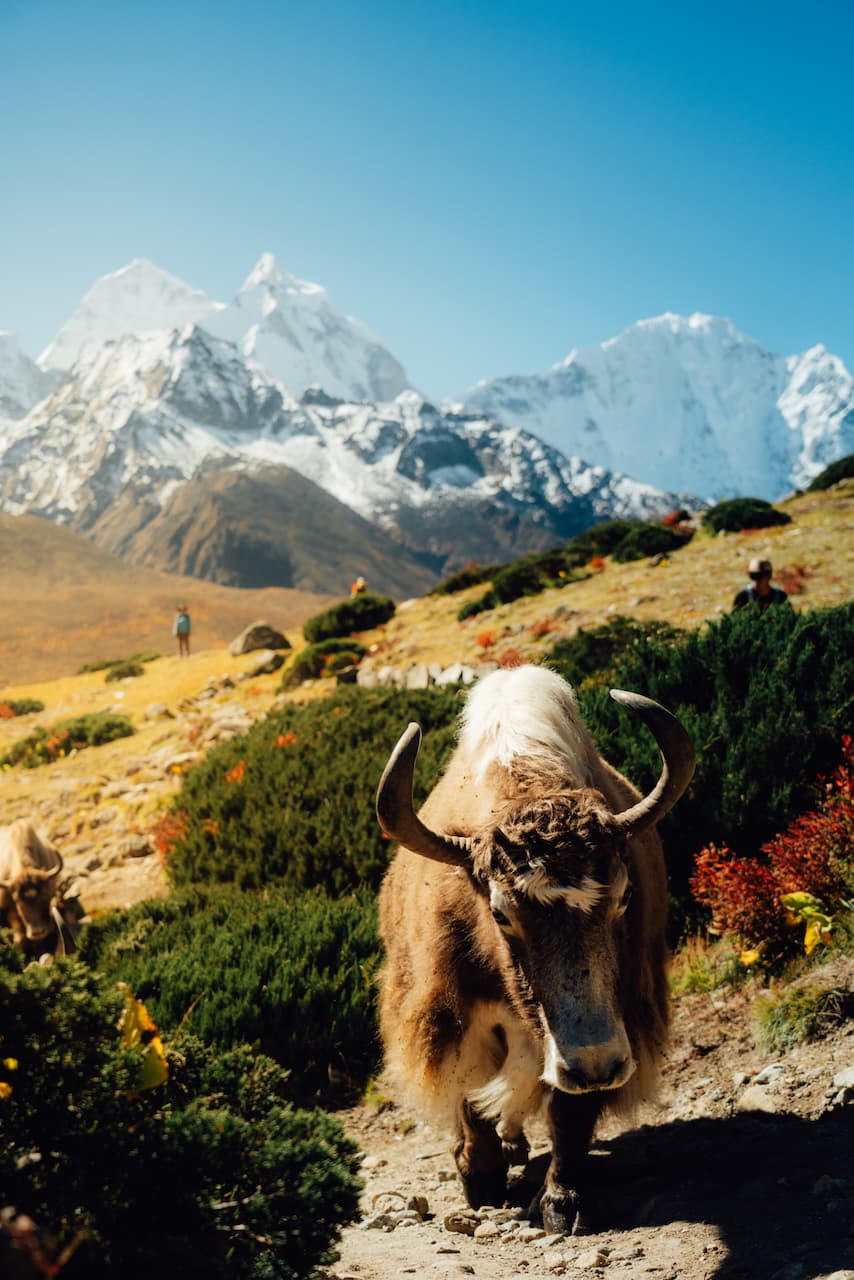
The next day, we were off on trail to Dole. It was a beautiful sunny morning, and we got a beautiful view of Ama Damblam and Thamserku out of Khumjung before the afternoon clouds rolled in. Herds of yak carrying empty gas cylinders were already on their daily commute down.
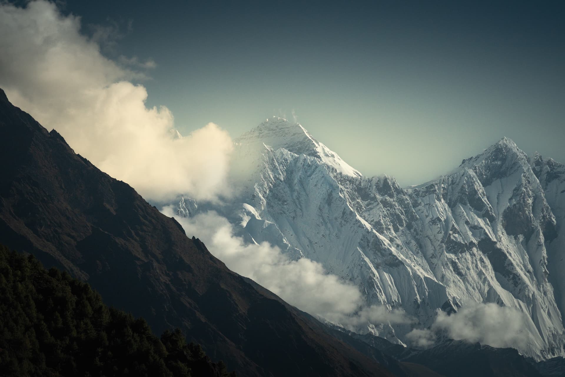
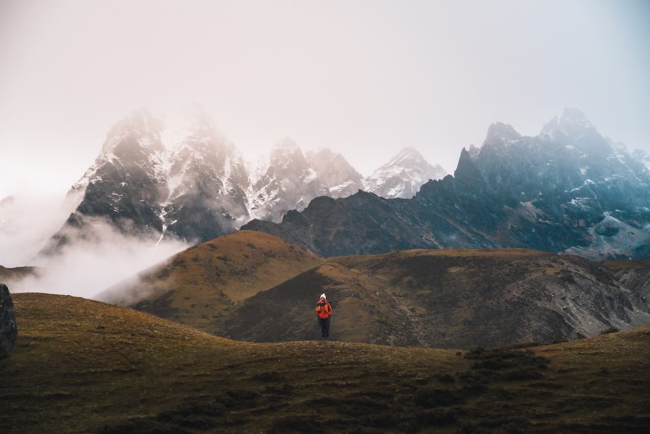
The mid-day clouds rolled in like clockwork around 11am, slowly covering up the peaks in front of us. On one hand, it creates these magical atmospheric conditions, but that's short lived. The rest of the day is spent hiking through the fog, which makes it a bit difficult to enjoy.
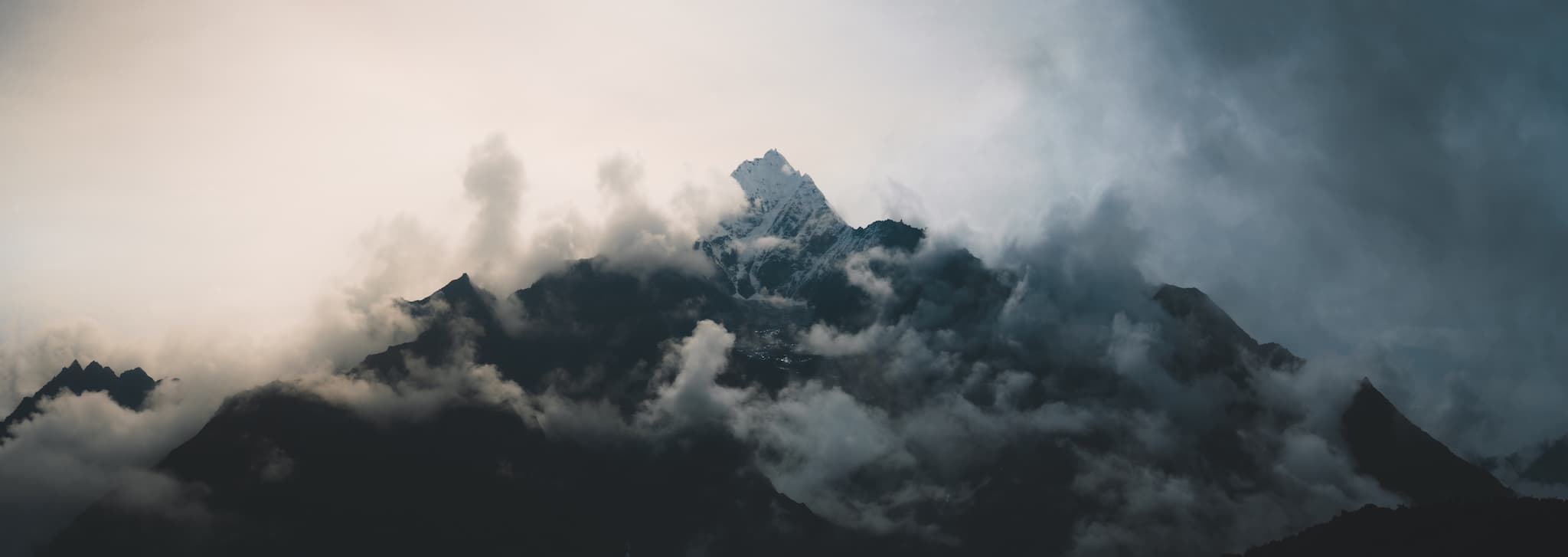
Thamserku looking absolutely epic shrouded by the mid-day fog. By the time we reached Dole, no mountains were to be seen.
Dole / डोले — 4,038m (13,290 ft)
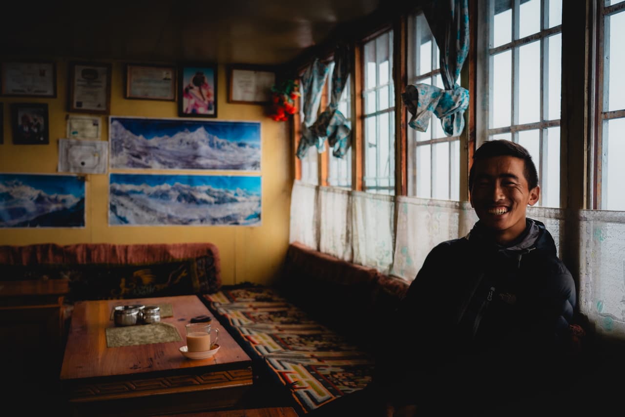
The cold was really seeping into our bones now. We were the only guests at the Dole View Lodge. The owner was a mountaineering veteran who had led many Everest expeditions back in the day. The walls were adorned with many photos of his alpine adventures, and we huddled around the fireplace with lemon ginger tea and listened to his stories about climbing Everest, Ama Dablam, Meru and Shishapangma among many other peaks.
Having these intimate conversations with the Sherpas, who have essentially transmuted their lives from guiding in the mountains to becoming business owners, it really gives you a newfound appreciation for their adaptability. Sherpas aren't just mountain climbers, even though they're genetically predisposed to be so. They've become alpinists out of necessity, and have jumped at the chance for a more comfortable life for their families by becoming lodge owners, or building businesses around the trekking and mountaineering industry. You can't blame them.
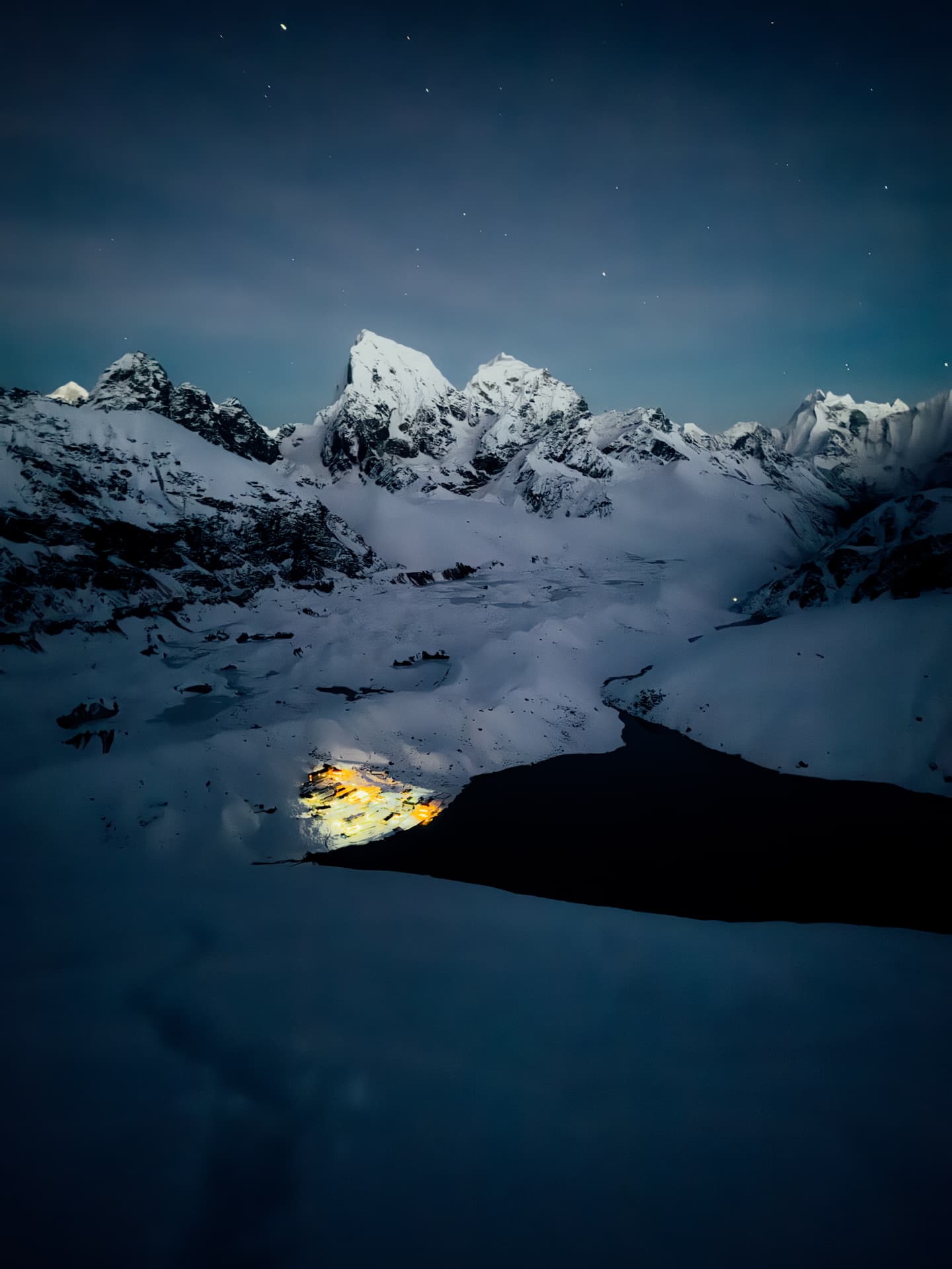
Machhermo / माछर्मो — 4,443m (14,580 ft)
5am charge for Gokyo. And off went.
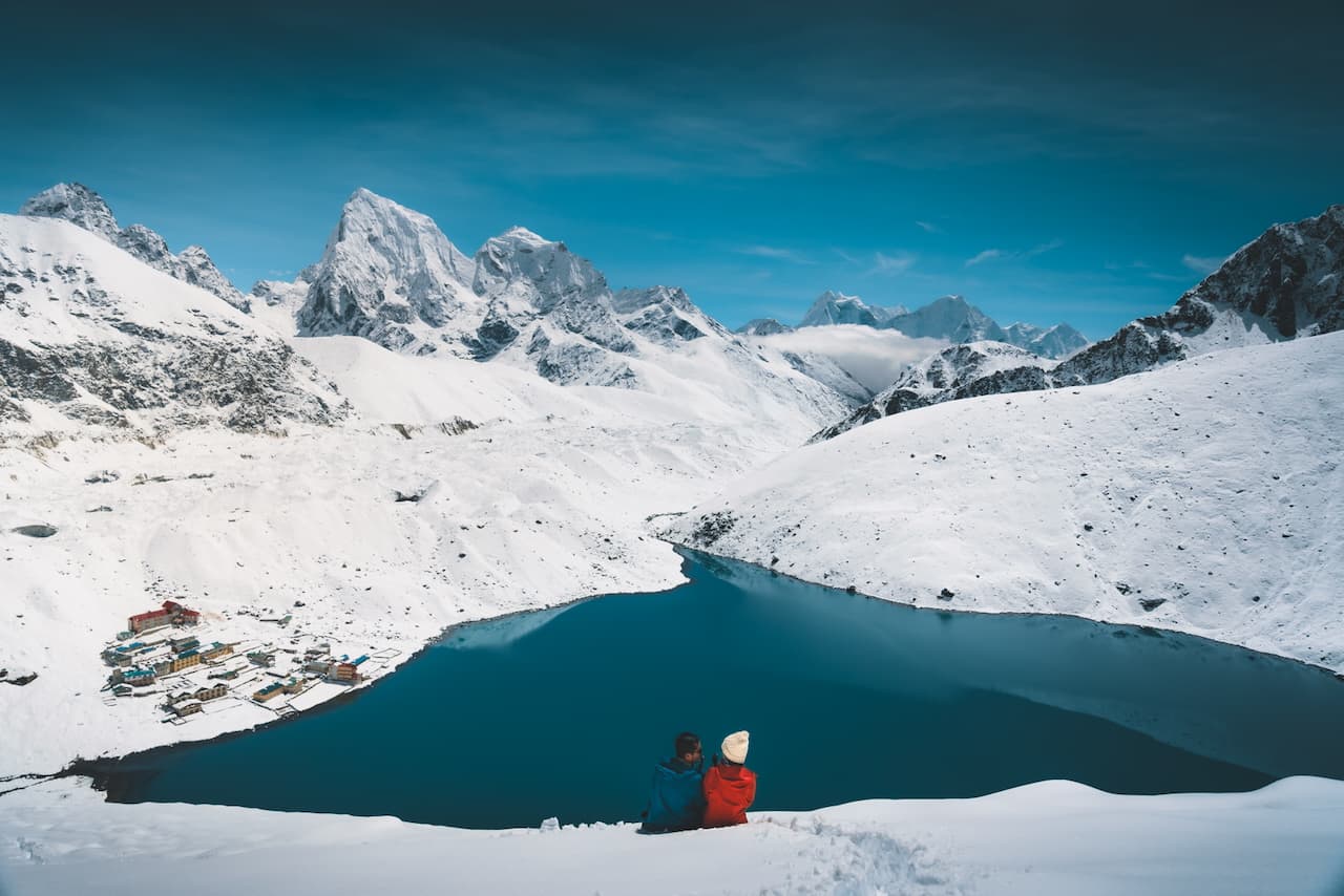
Gokyo / गोक्यो — 4,750m (15,600 ft)
Upon arrival, we were met with dense fog and precipitation. We were bummed, because the Gokyo valley is supposed to be one of the most scenic routes of the trek. We waited out the 2-day snowstorm playing Ludo and Taas with fellow trekkers. High altitude sickness slowly settled into our bodies (and minds).
Gokyo-Ri / गोक्यो रि — 5,357m (17,575 ft)
2 days later ... we woke up to some sun, finally. It was lovely sunrise, followed by a blindingly sunny day.
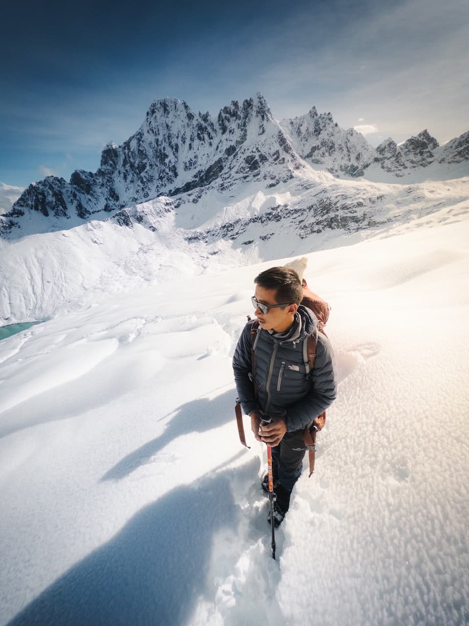
Everyone rushed to eat breakfast and gear up. You could sense the anxious spirit in the air. We all know hiking through fresh, knee-deep powder is less than ideal at such high altitudes, but we couldn't afford to wait any longer. Literally. Today was the day to make a run for the Summit of Gokyo-Ri.
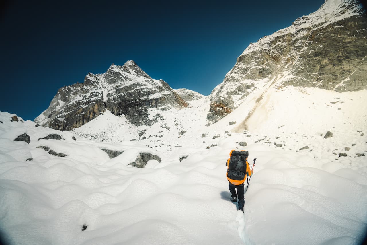
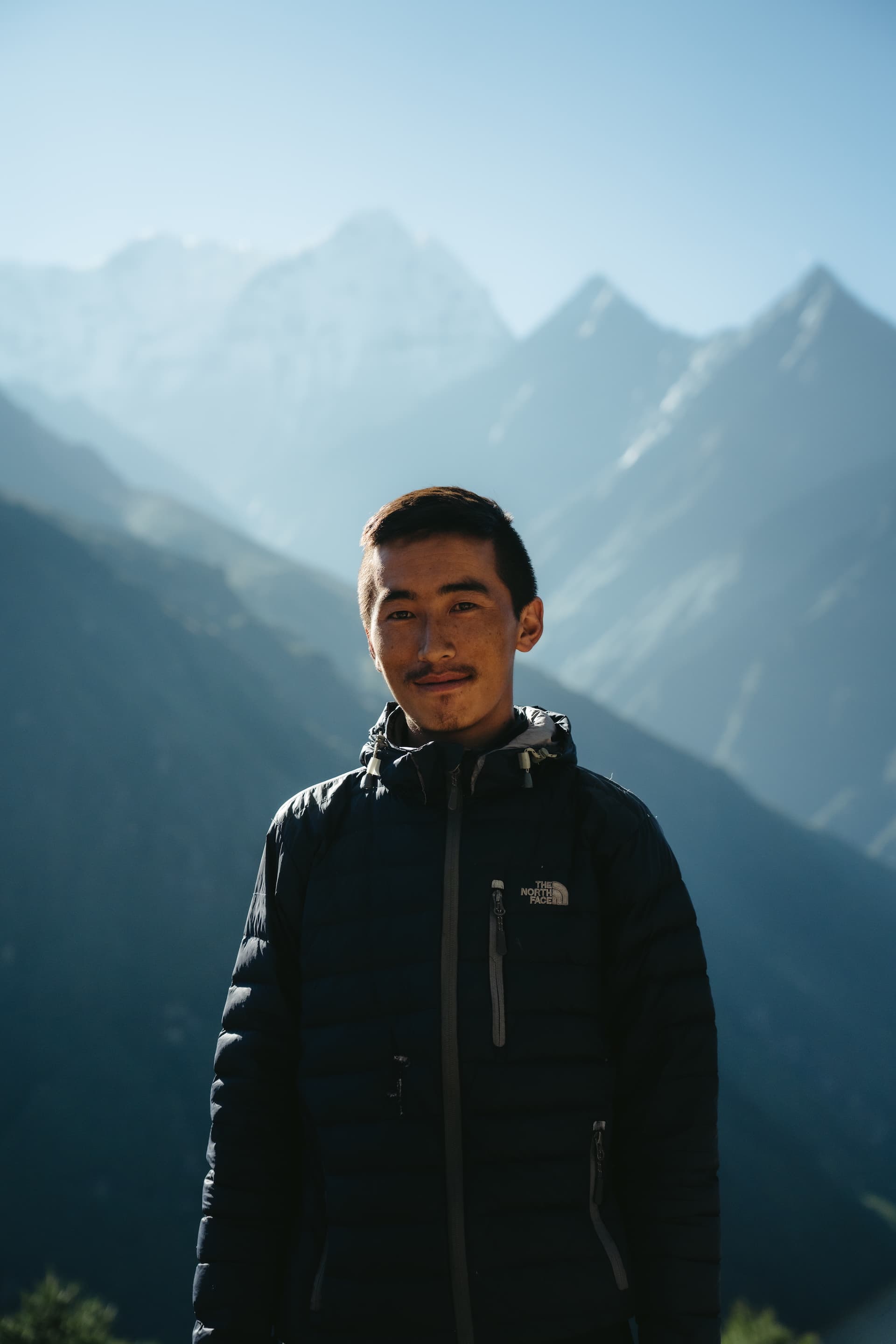
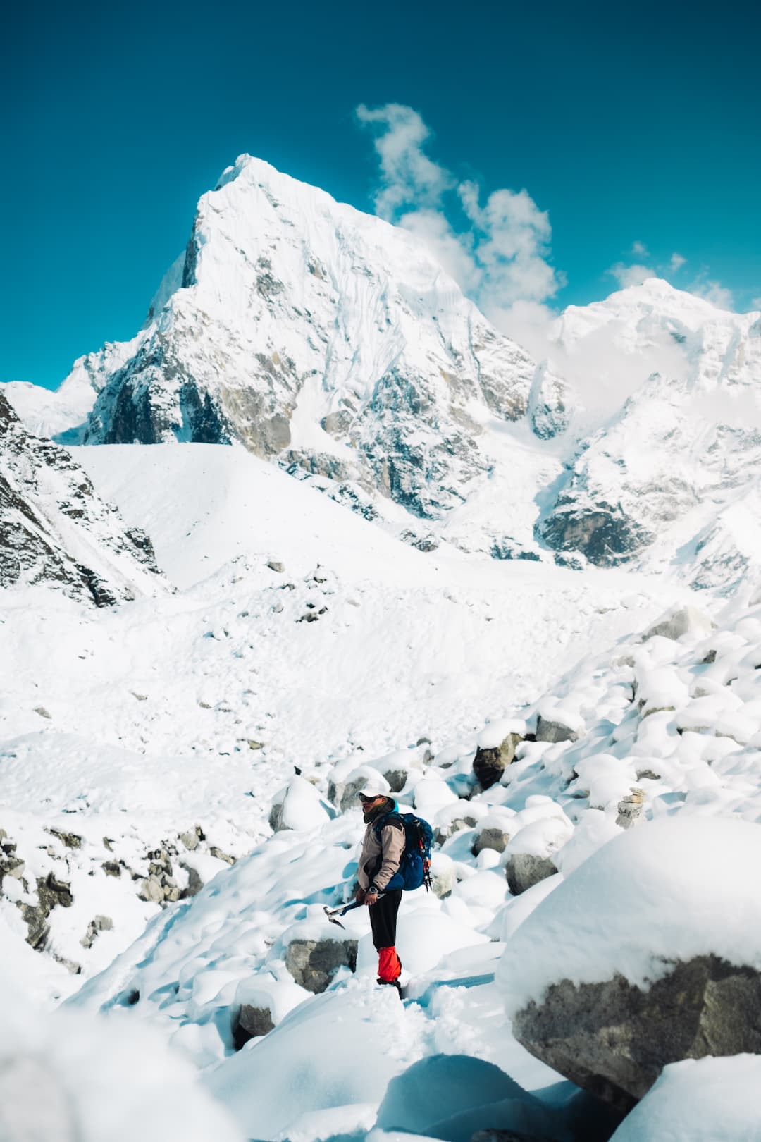
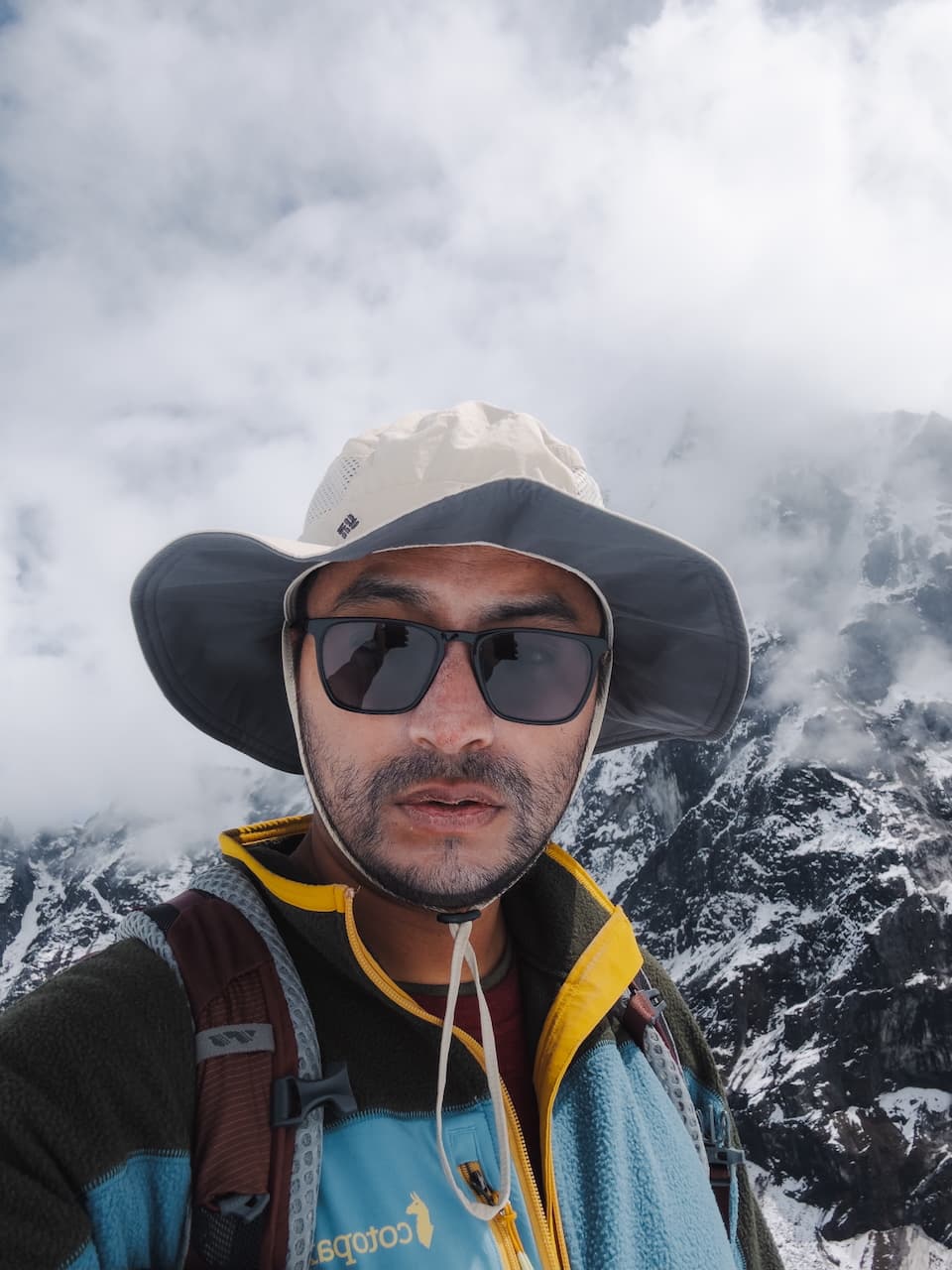
The hike was tough. The altitude really gets you, and navigating through fresh snow was absolutely brutal. Nevertheless, with Sonam leading the charge, every step took us closer. I mean... just look at this guy.
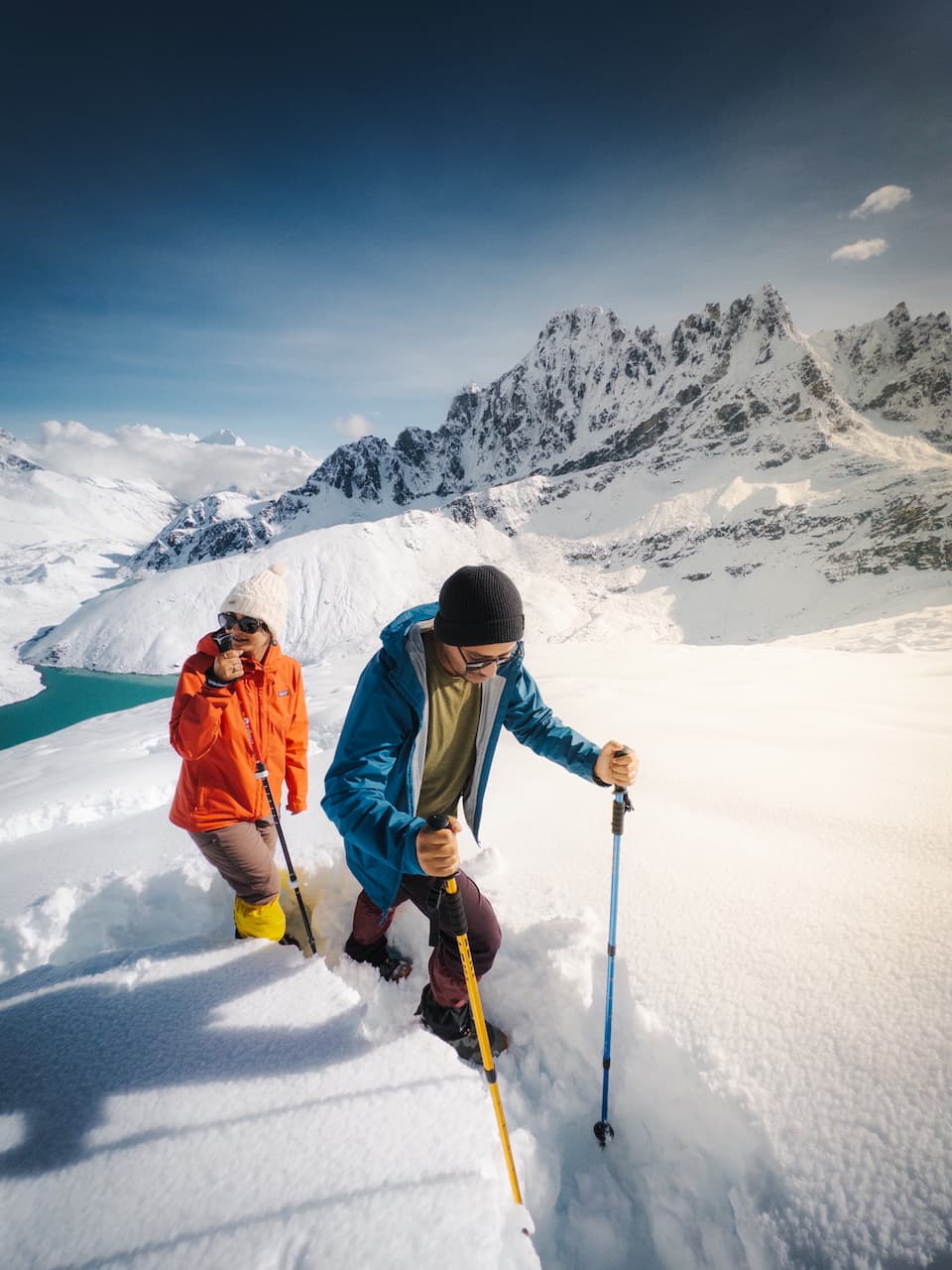
We stopped halfway for a rest. Everyone on the trail turned back because it was already late afternoon, and no one wanted to lead and open up the path of fresh snow. I had practically given up in spirit, but Sonam insisted that we push through. I was afraid we wouldn't be able to ascend further (and descend safely in the dark) but we persevered.
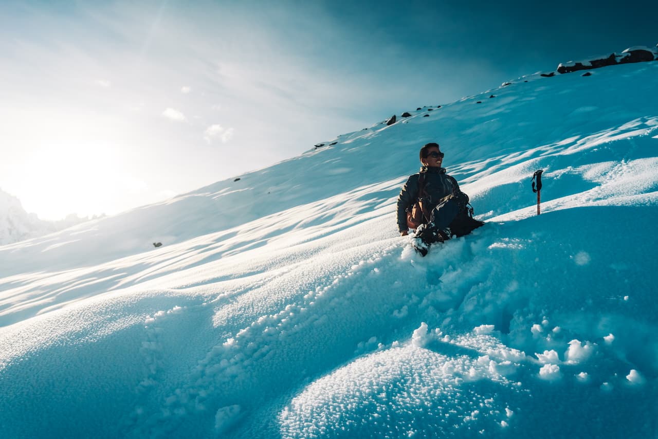
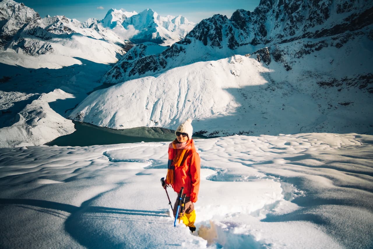
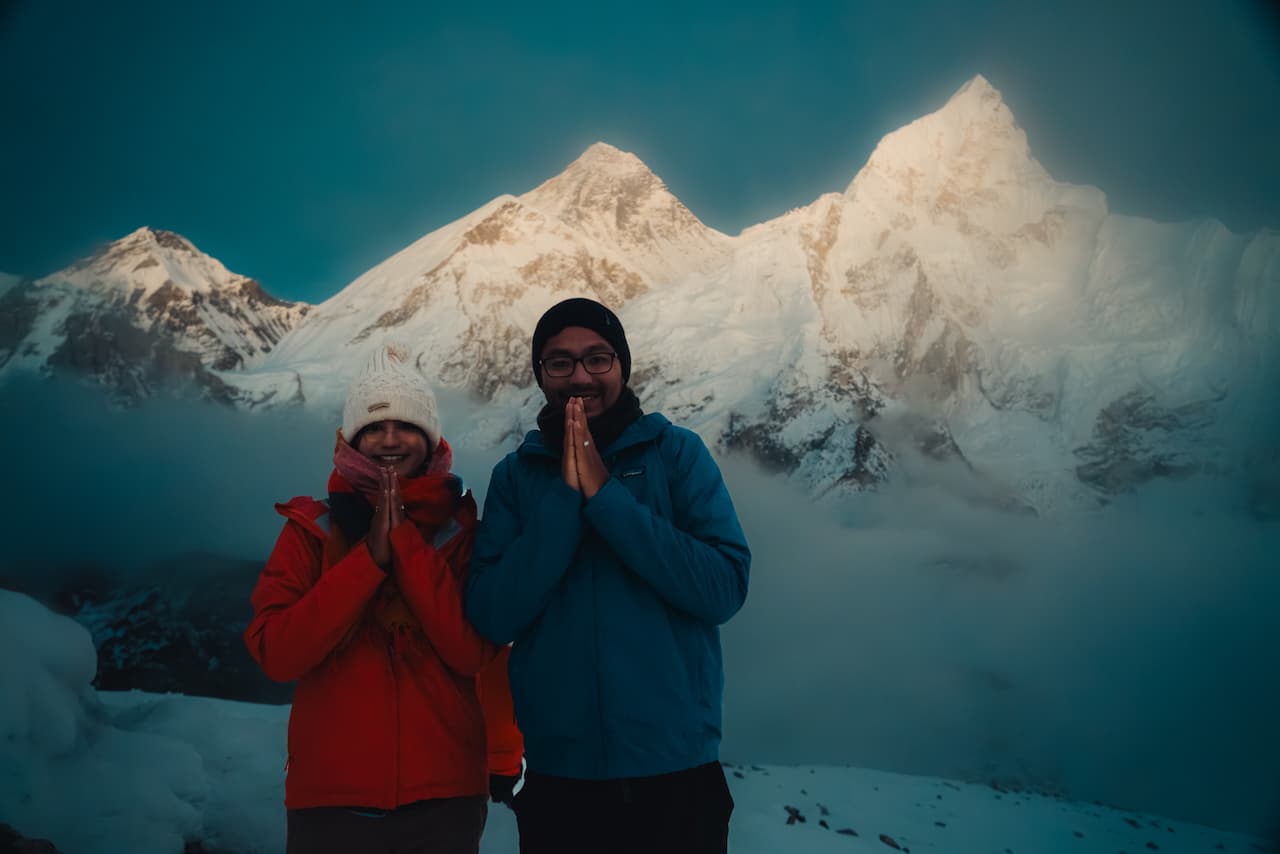
Thanks to Sonam, who constantly motivated us to push our limits. What is usually a 4 hour route took us 9 hours, having to wade through so much fresh snow from the previous days snowstorm. It was some of the hardest hiking we've ever done. I can't believe it, we made it to the summit... actually we stopped 20m shy of it because the snow was so deep we would've lost precious sunset viewing time wading through the snow.
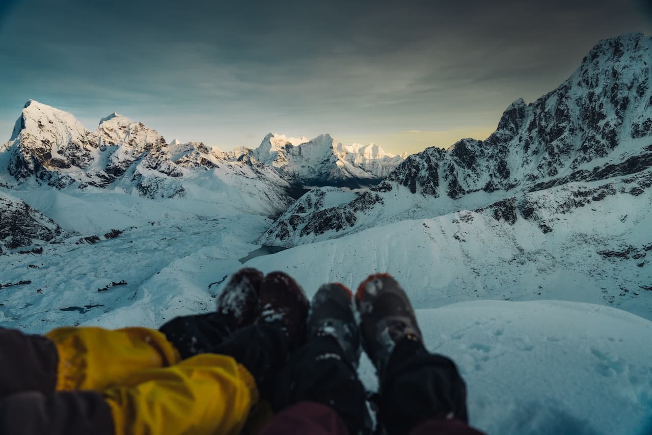
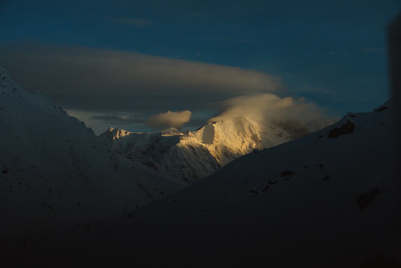
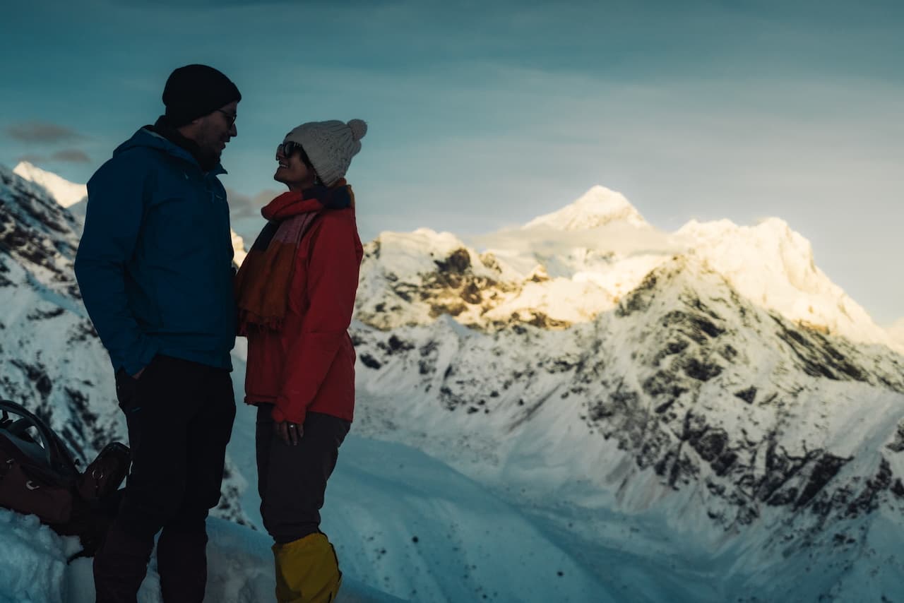
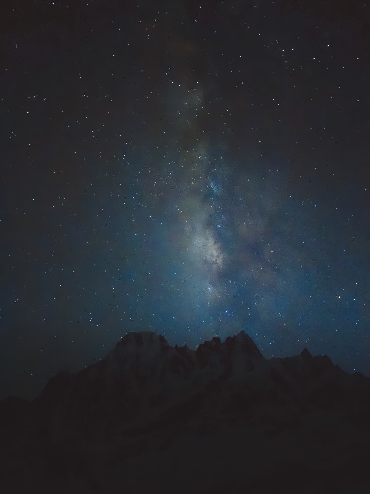
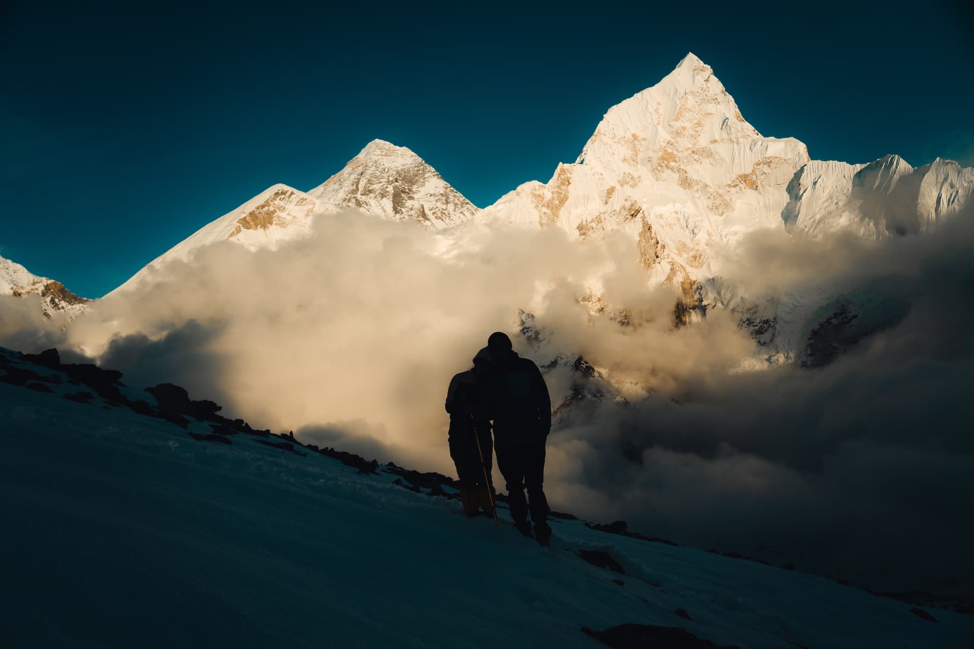
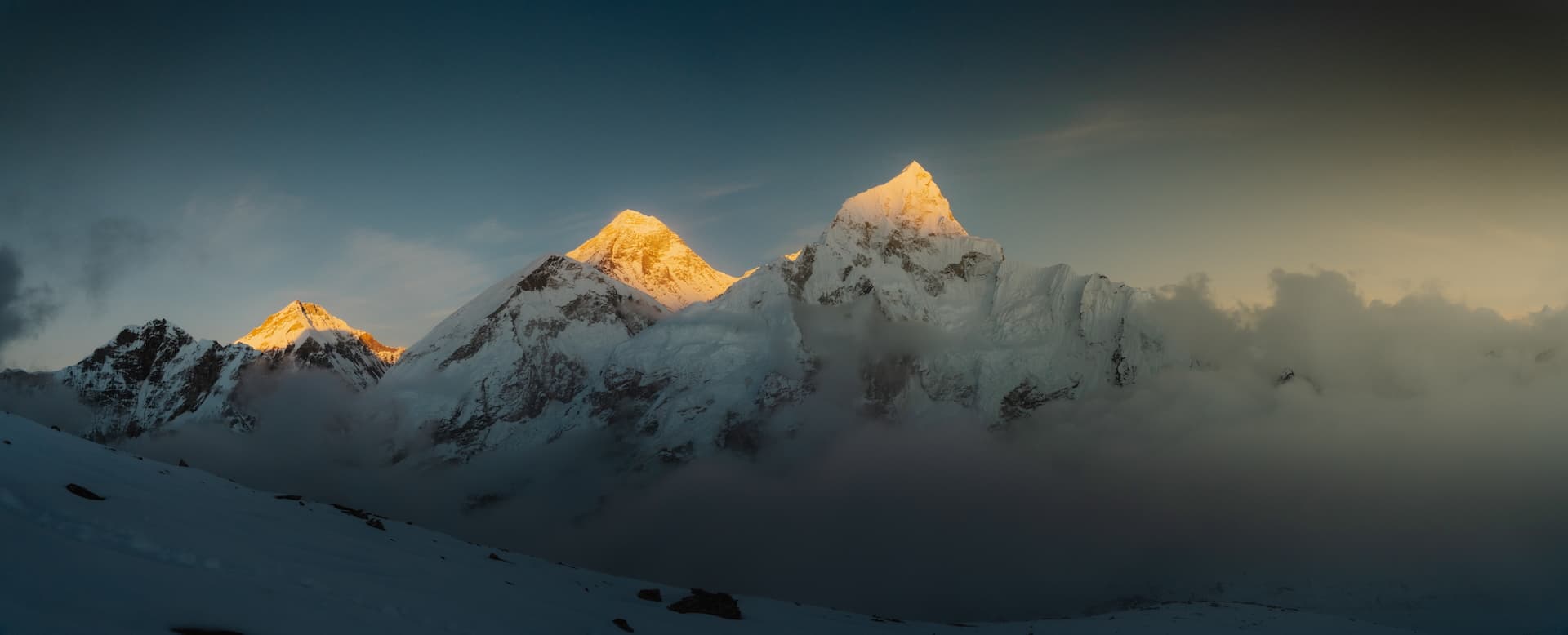
We were rewarded with magical views of Chomolungma and its neighbors, and clear Himalayan nightskies during the descent.
Thangnak / गोक्यो रि — 4,645m (15,240 ft)
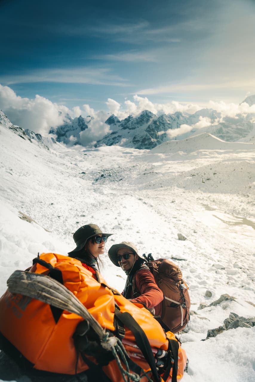
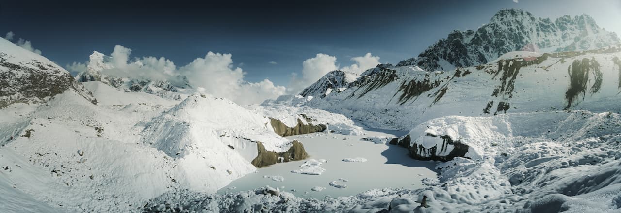
Traversing Ngozumpa Glacier, the longest glacier in the Himalayas. A treacherous path through some tricky terrain, it was completely obscured by blinding white snow. With the help of some kind fellas, we navigated this ever-changing route, dodging crevasses and unstable ice formations, reaching the next village just after nightfall.
There's nothing quite like hearing the echos and creaks of a vast sea of ice that is in perpetual motion.
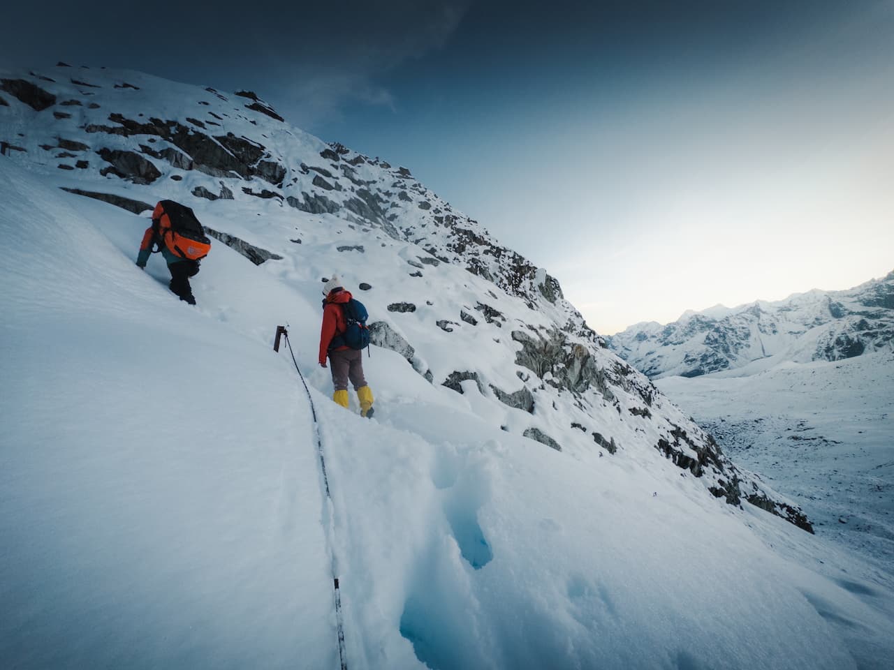
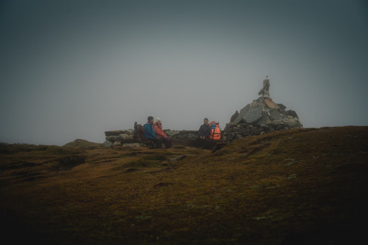
Dzongla via Cho La Pass / जोंगला — (5,387m / 17,600 ft)
A heart-wrenching 18 hour journey through Cho La Pass. We were challenged physically and mentally as we hiked through fresh snowpack the entire route, most of it being knee-high. Perhaps it's the combination of the blazing hot sun and melting snow coming down the mountain, but the thought of being caught in a snowslide crossed my mind many times. We even contemplated turning back.
Being alone and no one else to share the trail with — in these borderline unsafe conditions — we've never felt so pushed out of our comfort zones. God forbid something happen to one of us out there... I had to push those thoughts aside. At 17k feet high, every step felt insurmountable, and I was left feeling completely drained for the next 5-10 breaths. It's one of those things where, when you're in it, you wish it wasn't happening to you. But when all is said and done, you're glad it happened. As per usual, we were handsomely rewarded by the giants around us.
A huge thanks to the Sonam, our mighty guide who burst through walls of snow nonstop while carrying a 25kg load on his back. I've never seen someone so strong and so calm even in the harshest situations. Our journey would not have been successful without him. Every other mountain guide we met was hesitant to forge a path through the snow, and circumnavigated this beautiful path via an easier route. Can't express how lucky we are to have had such a badass taking us through these mountains.
Lobuche / लोबुचे — (4,928m / 16,170 ft)
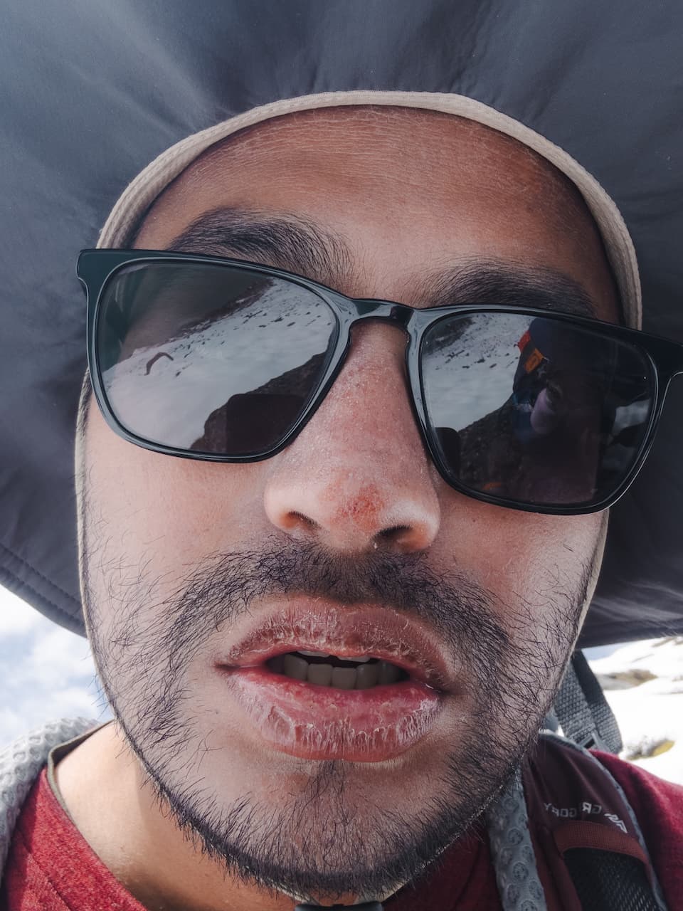
Kind of just felt crappy. My eyes were burning and red from the snow exposure, and my lips became rotten.
From Lobuche to Gorakshep.
Gorakshep / गोरक्षेप — (5,170m / 16,900 ft)
I felt so miserable from the altitude that I kind of just forget what happened. We spent less than a day because we wanted to descend ASAP. But it was time to climb to the highest point of the entire trek.
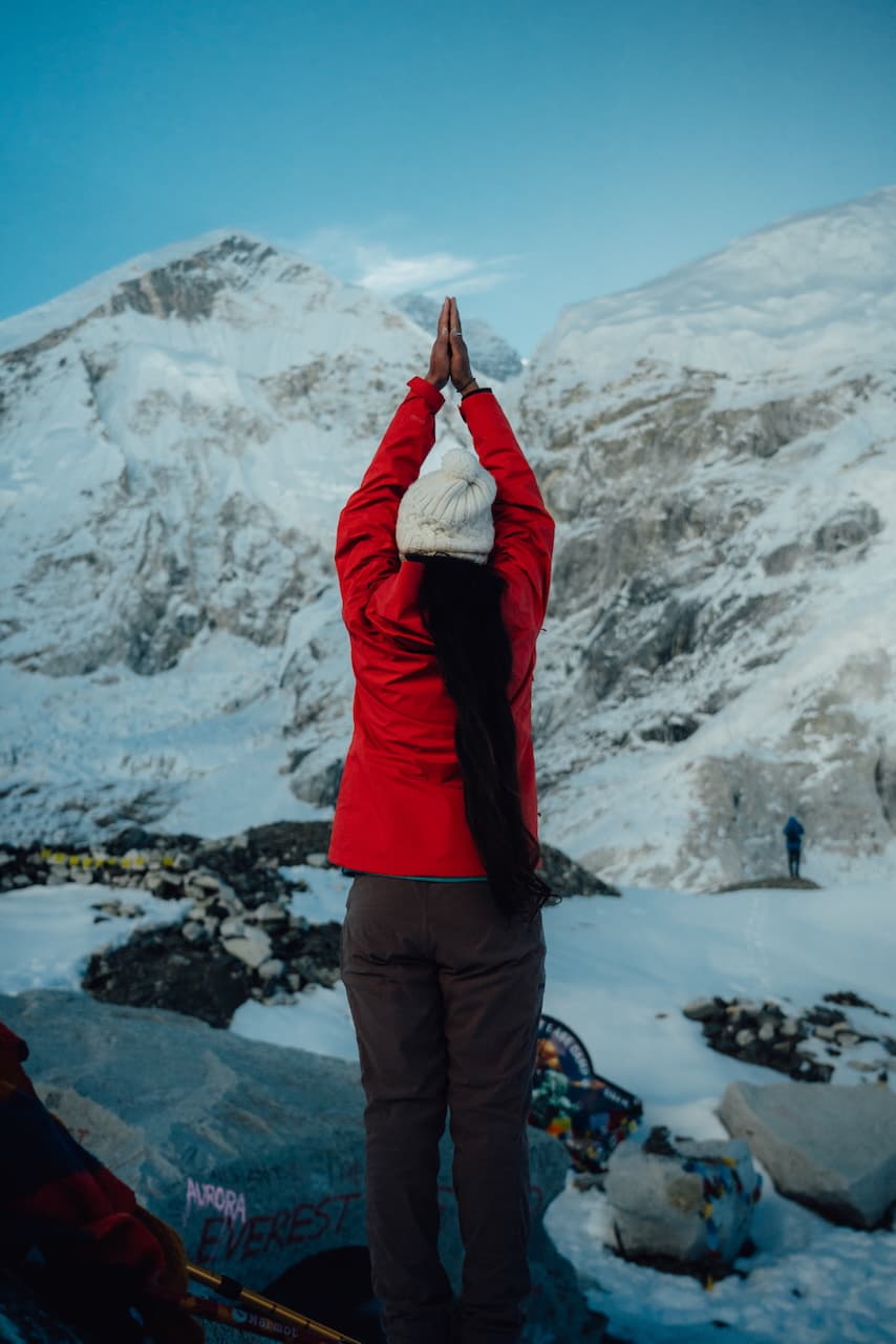
Kala Patthar / काला पत्थर (5,644m / 18,519 ft)
We set off to the summit of Kala Patthar.
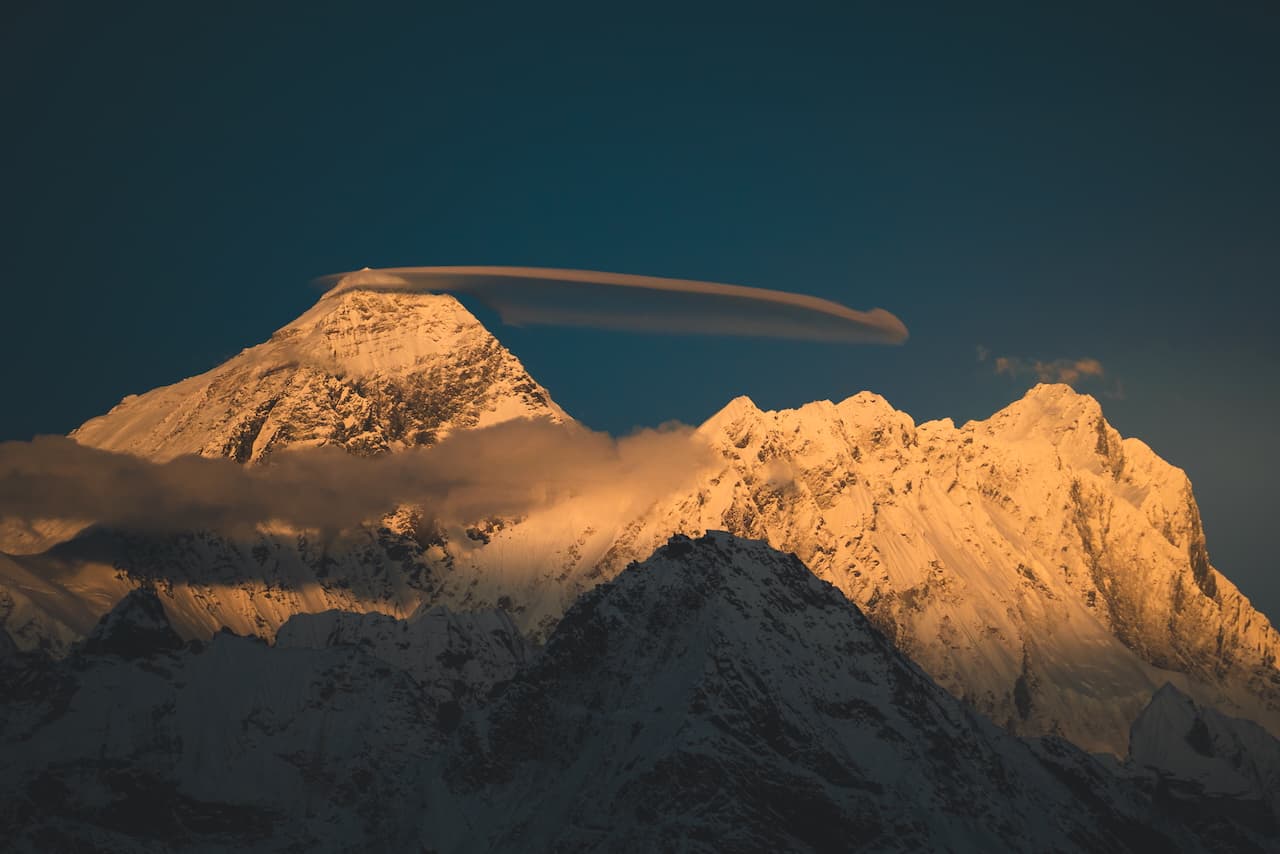
As the sun dipped, the signature view of Kala Patthar was revealed. Sun-kissed peaks of Everest and Lhotse.
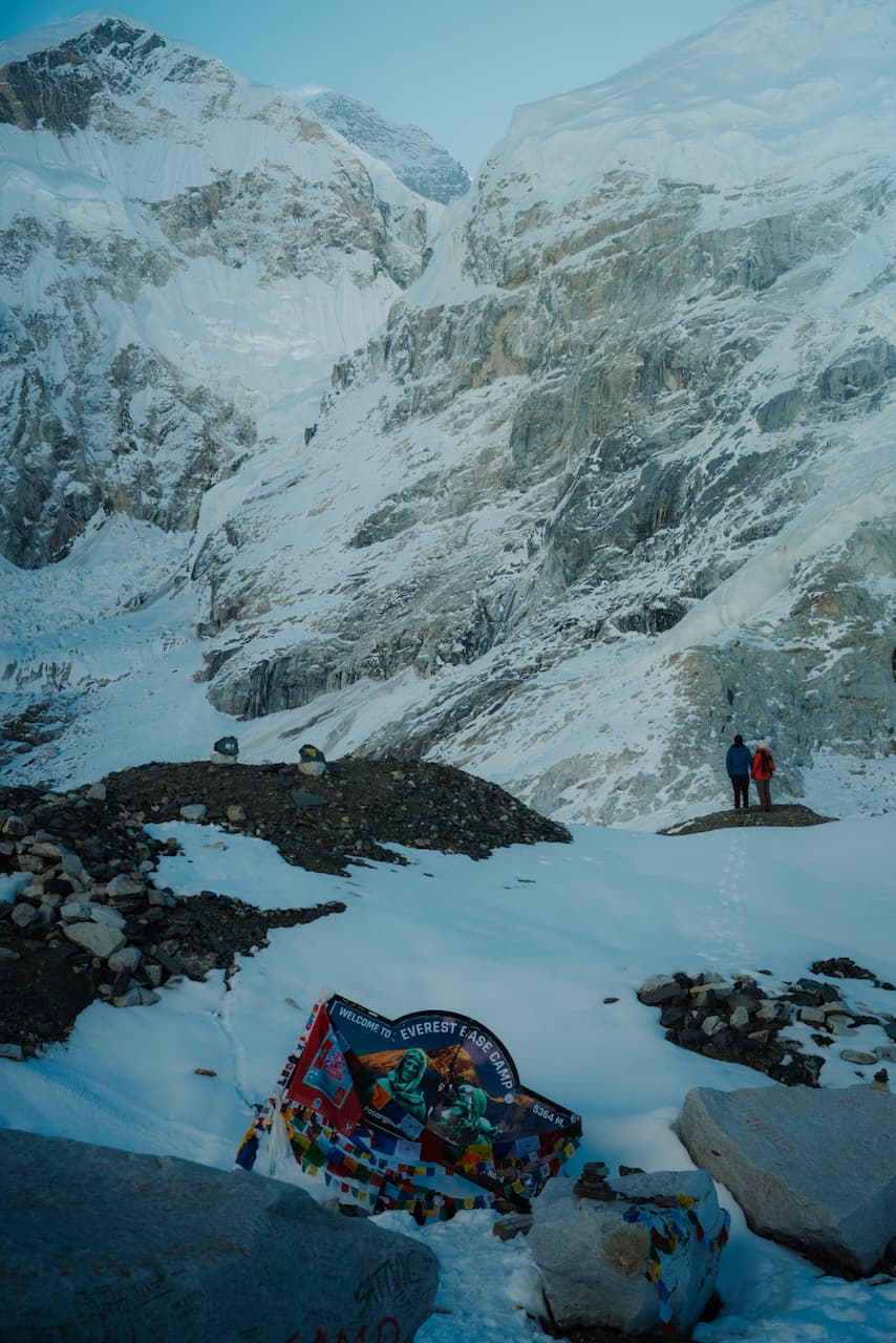
Everest Base Camp — (5,364m / 17,563 ft)
We woke up at 4am to make our way to the trail to Base Camp from Gorakshep.
Walking in the shadows, alongside the Khumbu Glacier. Eager to get to the final point of our journey. I was looking forward to the descent more than anything else.
Trail from Gorakshep to Dingboche.
Dingboche / दिङबोचे — (4,410 m / 14,470 ft)
Trail from Dingboche to Namche.
Namche Bazaar / नाम्चे बजार — 3,440m (11,200 ft)
Lukla
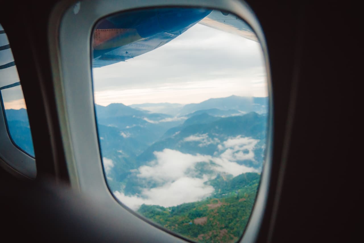
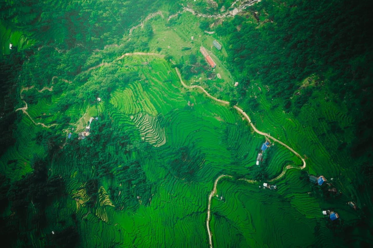
Due to cloudy weather, we had to take a helicopter out of the airport. Bonus points, because Solukhumbu from above is absolutely gorgeous.
There just isn't much one can say after a journey into the heart of the Khumbu. It's hard to capture the whirlwind of experiences—the oxygen-starved delusions at high altitudes, the heartwarming hospitality of the Sherpas, the sea of doubts and fear that stands between every step, followed by unreal, mind-boggling views of the Himalayas. A long, winding path with the mighty Chomolungma (or Everest, as the world knows it) as the North Star, it comes to me as a bit of a surprise that this trek we call the Everest Base Camp trek involves so much more than a single mighty mountain.
